| ©The Archaeological Settlements of Turkey - TAY Project | ||||||
|
|
||||||
Yüceler |
||||||
|
|
||||||
| Ages | Maps | Photos | ||||
| Palaeolithic/Epipalaeolithic |
 |
 |
||||
|
|
||||||
|
Type:
|
Single Findspot | |||||
|
Altitude:
|
m | |||||
|
Diameter:
|
m- Direction: | |||||
|
|
||||||
|
Region:
|
Black Sea | |||||
|
Province:
|
Ordu | |||||
|
District:
|
Ünye | |||||
|
Village:
|
Yüceler | |||||
|
|
||||||
|
|
||||||
|
|
||||||
|
TAYEx:
|
Not visited - 19/6/2003 | |||||
|
|
||||||
|
Registration State:
|
For detailed registration information please refer to Turkish pages. | |||||
 |
||||||
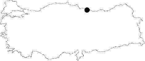
| Location: This site is west-northwest of the city of Ordu; near the caves and rock-shelters west of the terraces east of the Cevizdere Stream. It is west of the village of Yüceler which lies 7-8 km east-southeast of the coastal town of Ünye. |
| Geography and Environment: The caves and rock-shelters by the Cevizdere Stream can be seen from the railroad tracks north of the village of Yüceler. South of this village is a row of low mountains formed from igneous rock with three stepped terraces on their northern face. These terraces are approximately 5; 10; 15 and 20 m above sea-level. |
| Destruction Details: During the survey performed by Özsait et al. in 2006 it was found that the settlement was destructed due to illicit diggings. In the mean time the complete area is under the pollution threat by Ünye Çimento cement production facilities [Özsait 2008:295]. |