|
©The Archaeological Settlements of Turkey - TAY Project
|
|
|
|
|
|
Yüceler |
|
|
For site maps and drawings please click on the picture... 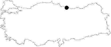 |
For photographs please click on the photo...  |
|
Type:
|
Single Findspot |
|
Altitude:
|
m |
|
Region:
|
Black Sea |
|
Province:
|
Ordu |
|
District:
|
Ünye |
|
Village:
|
Yüceler |
|
Investigation Method:
|
Survey |
|
Period:
|
AP ÜP OP |
|
|
|
 |
|
| Location: This site is west-northwest of the city of Ordu; near the caves and rock-shelters west of the terraces east of the Cevizdere Stream. It is west of the village of Yüceler which lies 7-8 km east-southeast of the coastal town of Ünye. |
| Geography and Environment: The caves and rock-shelters by the Cevizdere Stream can be seen from the railroad tracks north of the village of Yüceler. South of this village is a row of low mountains formed from igneous rock with three stepped terraces on their northern face. These terraces are approximately 5; 10; 15 and 20 m above sea-level. |
| History: |
| Research and Excavation: Kökten who discovered the site during his 1944-45 survey of the Yüceler area revisited it in 1963. Following his second visit; he announced that he planned to excavate at the site. Although Kökten has not published further research he conducted at the site; M.J. Mellink reports that he excavated at TILKIKAYA and TOZKOPARAN. We suspect that these must be the names of a couple of the caves and rock-shelters indicated on a 1:100.000 map. |
| Stratigraphy: |
| Small Finds: On the flanks of the third terrace on the northern face of the mountains; Kökten found a roughly made Chelléen (Abbevillien) biface handaxe [Kökten 1963a:fig.1]. The cemented sand and grit on the dorsal face indicates that the tool was brought to its provenience from the fill of the upper terraces by natural agents. The researcher assigns this terrace to the Lower Pleistocene. The seconds terrace beneath this yielded two Moustério-Aurignacien blade scrapers; one end-notched scraping tool on a flake; a rounded scraper; a blade knife; and a massive flake scraper [Kökten 1963a:lev.2]. These tools were found in the silty and gravelly layer above the flint veins in the upper section of the second terrace. Kökten suggests that this terrace must have been formed in the Würm Glacial Period and assigns the tools to the Upper Palaeolithic. Although it is not published by Kökten; M.J. Mellink mentions that Kökten opened a test trench near Tozkoparan which yielded Upper Palaeolithic; Chalcolithic; and Early Bronze Age artifacts [Mellink 1966:141]. In her report Mellink also mentions that Kökten found Middle and Upper Palaeolithic tools near Tilkikaya [ibid]. Yalçinkaya includes this site in her list of Lower Palaeolithic Anatolian sites. |
| Remains: |
| Interpretation and Dating: |