| ©The Archaeological Settlements of Turkey - TAY Project | ||||||
|
|
||||||
Yassi Höyük / Gordion |
||||||
|
|
||||||
| Ages | Maps | Photos | ||||
| EBA IA 14C |
 |
 |
||||
|
|
||||||
|
Type:
|
Mound | |||||
|
Altitude:
|
700 m | |||||
|
Diameter:
|
m- Direction: | |||||
|
|
||||||
|
Region:
|
Central Anatolia | |||||
|
Province:
|
Ankara | |||||
|
District:
|
Polatli | |||||
|
Village:
|
Yassihöyük | |||||
|
|
||||||
|
|
||||||
|
|
||||||
|
TAYEx:
|
Visited - 2/7/2002 | |||||
|
|
||||||
|
Registration State:
|
Registered For detailed registration information please refer to Turkish pages. | |||||
 |
||||||
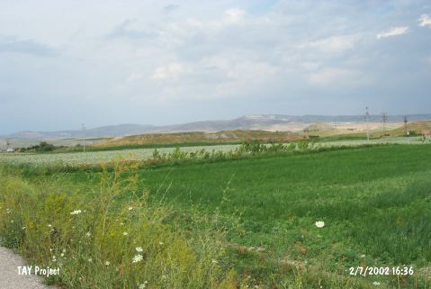
| Location: It is located next to the Yassihöyük Village; north of the Polatli District; west of Ankara Province. The cemetery of the second millennium BC lies immediate southeast of the village. |
| Geography and Environment: It is located on the eastern side of the Sakarya River. It is one of the biggest mounds in this region. It is considered as the ancient Gordion settlement of the Phrygian Period together with the settlements in the vicinity. The ridges on the south house tumuli. The area between tumulus H and I on the first ridge; east of the river; some 850 km northeast of the mound was employed as a cemetery. |
| Destruction Details: |