| ©The Archaeological Settlements of Turkey - TAY Project | ||||||
|
|
||||||
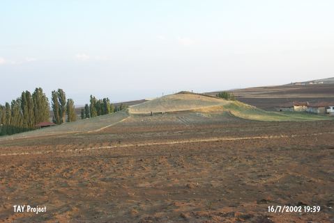
Unur Tepesi |
||||||
|
|
||||||
| Ages | Maps | Photos | ||||
| EBA |
 |
 |
||||
|
|
||||||
|
Type:
|
Mound | |||||
|
Altitude:
|
1020 m | |||||
|
Diameter:
|
100 m- Direction: NW-SE | |||||
|
|
||||||
|
Region:
|
Central Anatolia | |||||
|
Province:
|
Çankiri | |||||
|
District:
|
Merkez | |||||
|
Village:
|
Ünür | |||||
|
|
||||||
|
Destruction :
|
Agriculture - Contemporary Settlements | |||||
|
|
||||||
|
TAYEx:
|
Visited - 16/7/2002 | |||||
|
|
||||||
|
Registration State:
|
Registered For detailed registration information please refer to Turkish pages. | |||||
 |
||||||
| Location: |
| Geography and Environment: |
| Destruction Details: The mound is being damaged by agricultural activities and illicit digging. Its surroundings and surface is planted; north part is cultivated. There are houses on southwest and west-northwest skirts of the mound [TAYEx 16.7.2002]. |