|
©The Archaeological Settlements of Turkey - TAY Project
|
|
|
|
|
|
Unur Tepesi |
|
|
For site maps and drawings please click on the picture...  |
For photographs please click on the photo... 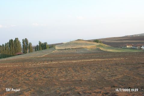 |
|
Type:
|
Mound |
|
Altitude:
|
1020 m |
|
Region:
|
Central Anatolia |
|
Province:
|
Çankiri |
|
District:
|
Merkez |
|
Village:
|
Ünür |
|
Investigation Method:
|
Survey |
|
Period:
|
|
|
|
|
 |
|
| It is located in Ünür (Unur) Village; east of Çankiri Province. It was discovered by A. Gökoglu. It measures 15 m in height and 50 m in diameter. It is surrounded by arable fields. Sherds of the straw-tempered; coarse handmade; exteriorly and interiorly red colored ware as well as the grit tempered; fine pasted; handmade; exteriorly and interiorly in gray colored; burnished ware were collected from the surface. Also found are wheelmade sherds. It takes place in the registered archaeological sites list prepared by Ministry of Culture and Tourism. |
| Location: |
| Geography and Environment: |
| History: |
| Research and Excavation: |
| Stratigraphy: |
| Small Finds: |
| Remains: |
| Interpretation and Dating: |