| ©The Archaeological Settlements of Turkey - TAY Project | ||||||
|
|
||||||
Tepetarla |
||||||
|
|
||||||
| Ages | Maps | Photos | ||||
| Neolithic Chalcolithic EBA |
 |
 |
||||
|
|
||||||
|
Type:
|
Mound | |||||
|
Altitude:
|
75 m | |||||
|
Diameter:
|
m- Direction: | |||||
|
|
||||||
|
Region:
|
Marmara | |||||
|
Province:
|
Bursa | |||||
|
District:
|
Karacabey | |||||
|
Village:
|
Tophisar | |||||
|
|
||||||
|
Destruction :
|
Agriculture - Highways, roads, bridges etc. | |||||
|
|
||||||
|
TAYEx:
|
Visited - 4/7/2000 | |||||
|
|
||||||
|
Registration State:
|
Registered For detailed registration information please refer to Turkish pages. | |||||
 |
||||||
| Location: |
| Geography and Environment: |
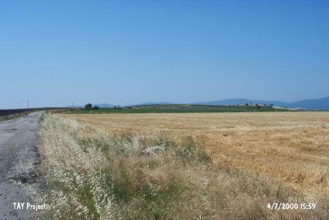
| Destruction Details: A road that joins the main road passes from the middle of the mound. Its surface is being used for agriculture. The structures of a farm are been built over the settlement [TAYEx 4.7.2000]. |