|
©The Archaeological Settlements of Turkey - TAY Project
|
|
|
|
|
|
Tepetarla |
|
|
For site maps and drawings please click on the picture...  |
For photographs please click on the photo... 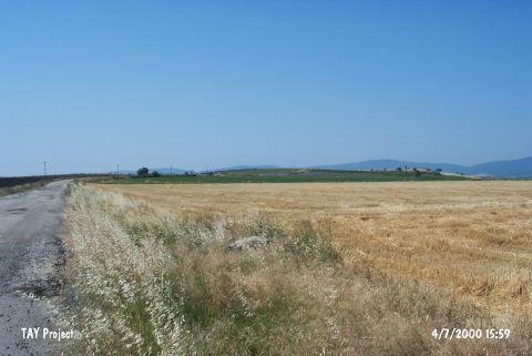 |
|
Type:
|
Mound |
|
Altitude:
|
75 m |
|
Region:
|
Marmara |
|
Province:
|
Bursa |
|
District:
|
Karacabey |
|
Village:
|
Tophisar |
|
Investigation Method:
|
Survey |
|
Period:
|
|
|
|
|
 |
|
| The mound lies west of Bursa; 1.7 km north of Tophisar village of Karacabey; east of the village road turning from the Bursa-Bandirma highway; close to the stream. It is discovered in 1989 by M. Özdogan and Late Chalcolithic Age-EBA; Hellenistic and Roman Period sherds are collected from the surface. No detailed information about the dimensions of the mound or the finds exists. Code H 9/1. It takes place in the registered archaeological sites list prepared by Ministry of Culture and Tourism. |
| Location: |
| Geography and Environment: |
| History: |
| Research and Excavation: |
| Stratigraphy: |
| Small Finds: |
| Remains: |
| Interpretation and Dating: |