| ©The Archaeological Settlements of Turkey - TAY Project | ||||||
|
|
||||||
Tell al Kanisah |
||||||
|
|
||||||
| Ages | Maps | Photos | ||||
| Neolithic Chalcolithic |
 |
 |
||||
|
|
||||||
|
Type:
|
Mound | |||||
|
Altitude:
|
150 m | |||||
|
Diameter:
|
m- Direction: | |||||
|
|
||||||
|
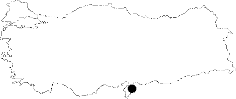
Region:
|
Mediterranean | |||||
|
Province:
|
Hatay | |||||
|
District:
|
Kirikhan | |||||
|
Village:
|
Muratpasa | |||||
|
|
||||||
|
Destruction :
|
Illicit Digging - Agriculture | |||||
|
|
||||||
|
TAYEx:
|
Visited - 22/7/2001 | |||||
|
|
||||||
|
Registration State:
|
For detailed registration information please refer to Turkish pages. | |||||
 |
||||||
| Location: The site lies 3.5 km northwest of Muratpasa Village; 8 km southeast of Kirikhan District of Hatay Province. It is locally known as Kilisetepe/Esentepe. |
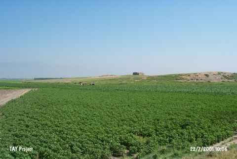
| Geography and Environment: The mound is fairly large and round and consists of two hills. The Muratpasa Water Canal passes very close to the mound. When the site was surveyed; the surrounding fields were not fertile. The other name of the mound is Tell Çolakköy; named after the closest village. |
| Destruction Details: The ruins of a church locates on the northern hill of the site consisting of two hills. There are pits of illicit diggings inside of the ruins. The skirts of the mound have been leveled due to agricultural activities. The smaller hill to the south is also being cultivated [TAYEx 22.7.2001]. |