| ©The Archaeological Settlements of Turkey - TAY Project | ||||||
|
|
||||||
Ayranli / Seyhpirim 1 |
||||||
|
|
||||||
| Ages | Maps | Photos | ||||
| Chalcolithic IA |
 |
 |
||||
|
|
||||||
|
Type:
|
Mound | |||||
|
Altitude:
|
1380 m | |||||
|
Diameter:
|
240 m- Direction: E-W | |||||
|
|
||||||
|
Region:
|
Eastern Anatolia | |||||
|
Province:
|
Mus | |||||
|
District:
|
Merkez | |||||
|
Village:
|
Boyuncuk | |||||
|
|
||||||
|
Destruction :
|
Agriculture | |||||
|
|
||||||
|
TAYEx:
|
Visited - 10/7/2003 | |||||
|
|
||||||
|
Registration State:
|
For detailed registration information please refer to Turkish pages. | |||||
 |
||||||
| Location: |
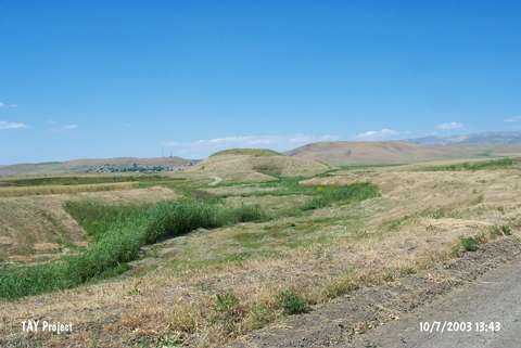
| Geography and Environment: |
| Destruction Details: The settlement has been damaged due to illicit diggings and agricultural activities. There are several pits on west-northwest and south slopes. Some old graves and a dirt road are on southeastern part [TAYEx 10.7.2003]. |