| ©The Archaeological Settlements of Turkey - TAY Project | ||||||
|
|
||||||
Sögüt Tarlasi 1 |
||||||
|
|
||||||
| Ages | Maps | Photos | ||||
| Palaeolithic/Epipalaeolithic |
 |
 |
||||
|
|
||||||
|
Type:
|
Habitation Site / Workshop | |||||
|
Altitude:
|
580 m | |||||
|
Diameter:
|
m- Direction: | |||||
|
|
||||||
|
Region:
|
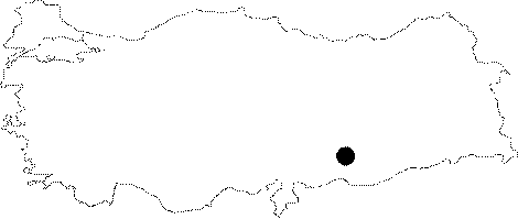
Southeastern Anatolia | |||||
|
Province:
|
Sanliurfa | |||||
|
District:
|
Bozova | |||||
|
Village:
|
Merkez | |||||
|
|
||||||
|
Destruction :
|
Agriculture | |||||
|
|
||||||
|
TAYEx:
|
Visited - 5/9/2001 | |||||
|
|
||||||
|
Registration State:
|
For detailed registration information please refer to Turkish pages. | |||||
 |
||||||
| Location: The mound lies 35 km northwest of the centrum of Sanliurfa; 2 km southwest of Bozova District. |
| Geography and Environment: The 2-3 m high; small mound is estimated to cover an area of 50x90 m due to the distribution of the finds. The name Sögüt Tarlasi (willow field) is assigned to the site because of the field south of the willows beside the lake northwest of the mound. The region is covered with fertile fields and is rich in water sources. |
| Destruction Details: The site is being used as a field [TAYEx 3.9.2001]. |