| ©The Archaeological Settlements of Turkey - TAY Project | ||||||
|
|
||||||
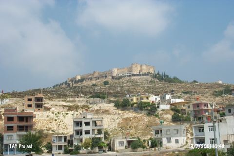
Silifke Kale |
||||||
|
|
||||||
| Ages | Maps | Photos | ||||
| Chalcolithic EBA |
 |
 |
||||
|
|
||||||
|
Type:
|
Flat Settlement | |||||
|
Altitude:
|
270 m | |||||
|
Diameter:
|
m- Direction: | |||||
|
|
||||||
|
Region:
|
Mediterranean | |||||
|
Province:
|
Mersin | |||||
|
District:
|
Silifke | |||||
|
Village:
|
Merkez | |||||
|
|
||||||
|
Destruction :
|
Contemporary Settlements | |||||
|
|
||||||
|
TAYEx:
|
Visited - 13/7/2001 | |||||
|
|
||||||
|
Registration State:
|
For detailed registration information please refer to Turkish pages. | |||||
 |
||||||
| Location: |
| Geography and Environment: |
| Destruction Details: The site which was occupied by the Ottoman Period castle named Silifke Kalesi is also being damaged by the two-story high café/restaurant building constructed by the municipality of Silifke [TAYEx 13.7.2001]. |