| ©The Archaeological Settlements of Turkey - TAY Project | ||||||
|
|
||||||
Sirçan Tepe |
||||||
|
|
||||||
| Ages | Maps | Photos | ||||
| Neolithic |
 |
 |
||||
|
|
||||||
|
Type:
|
Mound | |||||
|
Altitude:
|
1300 m | |||||
|
Diameter:
|
103 m- Direction: WNW-ESE | |||||
|
|
||||||
|
Region:
|
Central Anatolia | |||||
|
Province:
|
Aksaray | |||||
|
District:
|
Merkez | |||||
|
Village:
|
Bebek | |||||
|
|
||||||
|
|
||||||
|
|
||||||
|
TAYEx:
|
Visited - 4/8/2002 | |||||
|
|
||||||
|
Registration State:
|
Registered For detailed registration information please refer to Turkish pages. | |||||
 |
||||||
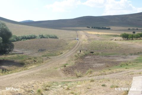
| Location: This site lies nearby the watering pool; 500 m north of Bebek Village; northeast of Aksaray Province. |
| Geography and Environment: The mound lies near a small stream; is 4.0 m high and has a 196 m base diameter. |
| Destruction Details: |