| ©The Archaeological Settlements of Turkey - TAY Project | ||||||
|
|
||||||
Senirce |
||||||
|
|
||||||
| Ages | Maps | Photos | ||||
| EBA |
 |
 |
||||
|
|
||||||
|
Type:
|
Mound | |||||
|
Altitude:
|
890 m | |||||
|
Diameter:
|
m- Direction: | |||||
|
|
||||||
|
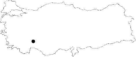
Region:
|
Mediterranean | |||||
|
Province:
|
Isparta | |||||
|
District:
|
Gönen | |||||
|
Village:
|
Senirce | |||||
|
|
||||||
|
Destruction :
|
Agriculture - Highways, roads, bridges etc. - Attention | |||||
|
|
||||||
|
TAYEx:
|
Visited - 1/7/2001 | |||||
|
|
||||||
|
Registration State:
|
Registered For detailed registration information please refer to Turkish pages. | |||||
 |
||||||
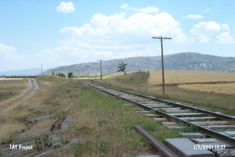
| Location: It lies nearby the railway; 1.5 km away from the Senirce Village; about 15 km north-northwest of the Isparta Province. |
| Geography and Environment: It is located in the Senirce Plain. It has suitable characteristics to be settled with an arable land in the surrounding territory. |
| Destruction Details: The mound has been cut by the railway [TAYEx 1.7.2001]. |