| ©The Archaeological Settlements of Turkey - TAY Project | ||||||
|
|
||||||
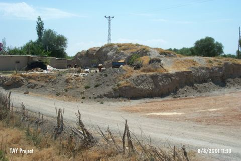
Ozan Höyük |
||||||
|
|
||||||
| Ages | Maps | Photos | ||||
| Chalcolithic EBA IA |
 |
 |
||||
|
|
||||||
|
Type:
|
Mound | |||||
|
Altitude:
|
1250 m | |||||
|
Diameter:
|
m- Direction: | |||||
|
|
||||||
|
Region:
|
Eastern Anatolia | |||||
|
Province:
|
Kahramanmaras | |||||
|
District:
|
Elbistan | |||||
|
Village:
|
Doganköy | |||||
|
|
||||||
|
Destruction :
|
Contemporary Settlements - Attention | |||||
|
|
||||||
|
TAYEx:
|
Visited - 7/8/2001 | |||||
|
|
||||||
|
Registration State:
|
For detailed registration information please refer to Turkish pages. | |||||
 |
||||||
| Location: |
| Geography and Environment: |
| Destruction Details: The top of the mound has been leveled and soil removed from all skirts except southern one. There are pits of illicit diggings on south skirt. There houses on northern skirt [TAYEx 7.8.2001]. |