| ©The Archaeological Settlements of Turkey - TAY Project | ||||||
|
|
||||||
Ortaca |
||||||
|
|
||||||
| Ages | Maps | Photos | ||||
| EBA IA |
 |
 |
||||
|
|
||||||
|
Type:
|
Mound | |||||
|
Altitude:
|
1035 m | |||||
|
Diameter:
|
144 m- Direction: WSW-ENE | |||||
|
|
||||||
|
Region:
|
Aegean | |||||
|
Province:
|
Kütahya | |||||
|
District:
|
Aslanapa | |||||
|
Village:
|
Ortaca | |||||
|
|
||||||
|
Destruction :
|
Agriculture | |||||
|
|
||||||
|
TAYEx:
|
Visited - 5/7/2004 | |||||
|
|
||||||
|
Registration State:
|
Registered For detailed registration information please refer to Turkish pages. | |||||
 |
||||||
| Location: |
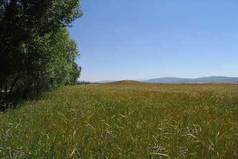
| Geography and Environment: |
| Destruction Details: The whole surface of the settlement is planted and it is surrounded by fields. The mound has lost its original height due to plowing [TAYEx 5.7.2004]. |