| ©The Archaeological Settlements of Turkey - TAY Project | ||||||
|
|
||||||
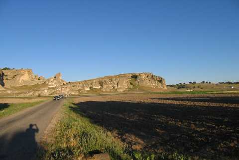
Asarkaya |
||||||
|
|
||||||
| Ages | Maps | Photos | ||||
| Palaeolithic/Epipalaeolithic Neolithic Chalcolithic IA |
 |
 |
||||
|
|
||||||
|
Type:
|
Flat Settlement | |||||
|
Altitude:
|
965 m | |||||
|
Diameter:
|
m- Direction: | |||||
|
|
||||||
|
Region:
|
Aegean | |||||
|
Province:
|
Kütahya | |||||
|
District:
|
Merkez | |||||
|
Village:
|
Sabuncu | |||||
|
|
||||||
|
|
||||||
|
|
||||||
|
TAYEx:
|
Visited - 3/7/2004 | |||||
|
|
||||||
|
Registration State:
|
Registered For detailed registration information please refer to Turkish pages. | |||||
 |
||||||
| Location: This site lies northeast of the city of Kütahya; 2 km south of the town of Sabuncular; in the area known as Asarkaya. |
| Geography and Environment: The geographical information provided by the researcher indicates that Asarkaya is a rock outcrop which lies on the northwestern skirts of Mount Türkmen. The finds were found on a slope of the rock outcrop and on the flat area beside it. The region is abundant in natural caves; which must have been attractive shelters for the first producers. |
| Destruction Details: |