| ©The Archaeological Settlements of Turkey - TAY Project | ||||||
|
|
||||||
Memishan Mevkii |
||||||
|
|
||||||
| Ages | Maps | Photos | ||||
| Palaeolithic/Epipalaeolithic |
 |
 |
||||
|
|
||||||
|
Type:
|
Habitation Site / Workshop | |||||
|
Altitude:
|
m | |||||
|
Diameter:
|
m- Direction: | |||||
|
|
||||||
|
Region:
|
Southeastern Anatolia | |||||
|
Province:
|
Adiyaman | |||||
|
District:
|
Samsat | |||||
|
Village:
|
Kovanoluk | |||||
|
|
||||||
|
Destruction :
|
Dams | |||||
|
|
||||||
|
TAYEx:
|
Not visited - 26/9/2001 | |||||
|
|
||||||
|
Registration State:
|
For detailed registration information please refer to Turkish pages. | |||||
 |
||||||
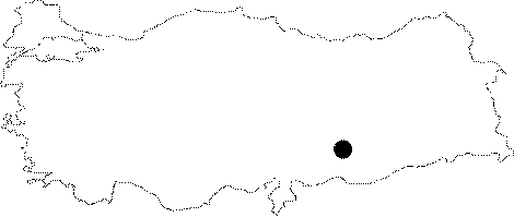
| Location: This site is in the province of Adiyaman; southeast of the city; immediately west of the northern meander of the Memishan Stream; approximately 1;500 m north-northwest of the village of Biriman which is north of the town of Samsat. This town is now submerged beneath the waters of the Atatürk Dam Lake. The survey code of the site is 51/19. |
| Geography and Environment: The site; approximately 400 m above sea level; is on the flat areas on the ridges of the Memiskan Stream; where the upper layers have been eroded; exposing the fill layers and the chipped stone tools and debitage products beneath. The site extent is not definite. This area was probably more than a temporary camp area; but a Palaeolithic habitation site. |
| Destruction Details: Memishan Mevkii is flooded by Atatürk Dam reservoir today [TAYEx 26.9.2001]. |