|
©The Archaeological Settlements of Turkey - TAY Project
|
|
|
|
|
|
Memishan Mevkii |
|
|
For site maps and drawings please click on the picture... 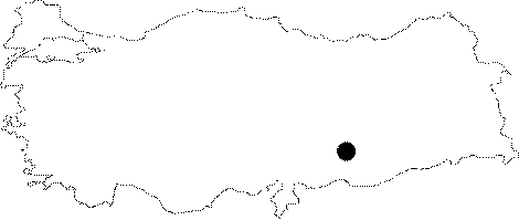 |
For photographs please click on the photo...  |
|
Type:
|
Habitation Site / Workshop |
|
Altitude:
|
m |
|
Region:
|
Southeastern Anatolia |
|
Province:
|
Adiyaman |
|
District:
|
Samsat |
|
Village:
|
Kovanoluk |
|
Investigation Method:
|
Survey |
|
Period:
|
ÜP |
|
|
|
 |
|
| Location: This site is in the province of Adiyaman; southeast of the city; immediately west of the northern meander of the Memishan Stream; approximately 1;500 m north-northwest of the village of Biriman which is north of the town of Samsat. This town is now submerged beneath the waters of the Atatürk Dam Lake. The survey code of the site is 51/19. |
| Geography and Environment: The site; approximately 400 m above sea level; is on the flat areas on the ridges of the Memiskan Stream; where the upper layers have been eroded; exposing the fill layers and the chipped stone tools and debitage products beneath. The site extent is not definite. This area was probably more than a temporary camp area; but a Palaeolithic habitation site. |
| History: |
| Research and Excavation: The site was discovered in 1977 by Mehmet Özdogan and his crew from the University of Istanbul; Faculty of Letters; Prehistory Section who researched the area expected to be flooded by the Atatürk Dam Lake in the Lower Euphrates Basin. The survey of this site was not systematic. |
| Stratigraphy: |
| Small Finds: The finds include some chipped stone tools with old patinas among which rounded and end scrapers predominate. Özdogan assigns these finds to the Upper Palaeolithic. |
| Remains: |
| Interpretation and Dating: |