| ©The Archaeological Settlements of Turkey - TAY Project | ||||||
|
|
||||||
Kültepe |
||||||
|
|
||||||
| Ages | Maps | Photos | ||||
| Chalcolithic EBA IA |
 |
 |
||||
|
|
||||||
|
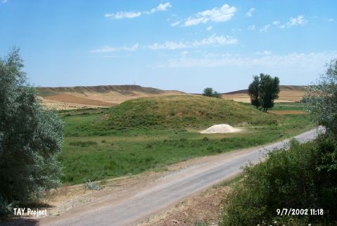
Type:
|
Mound | |||||
|
Altitude:
|
870 m | |||||
|
Diameter:
|
109 m- Direction: E-W | |||||
|
|
||||||
|
Region:
|
Central Anatolia | |||||
|
Province:
|
Kirikkale | |||||
|
District:
|
Delice | |||||
|
Village:
|
Çongar | |||||
|
|
||||||
|
Destruction :
|
Illicit Digging - Agriculture | |||||
|
|
||||||
|
TAYEx:
|
Visited - 9/7/2002 | |||||
|
|
||||||
|
Registration State:
|
Registered For detailed registration information please refer to Turkish pages. | |||||
 |
||||||
| Location: |
| Geography and Environment: |
| Destruction Details: The southeast skirt of the mound has been cut and there is an illicit digging pit on east slope [TAYEx 9.7.2002]. |