|
©The Archaeological Settlements of Turkey - TAY Project
|
|
|
|
|
|
Kültepe |
|
|
For site maps and drawings please click on the picture...  |
For photographs please click on the photo... 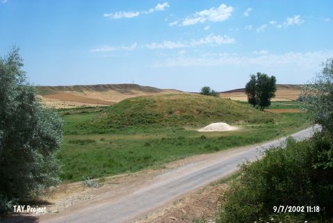 |
|
Type:
|
Mound |
|
Altitude:
|
870 m |
|
Region:
|
Central Anatolia |
|
Province:
|
Kirikkale |
|
District:
|
Delice |
|
Village:
|
Çongar |
|
Investigation Method:
|
Survey |
|
Period:
|
|
|
|
|
 |
|
| It is situated to the immediate north of the Çongar-Çerikli road, 4 km east of the Çongar Village, southwest of the Delice District in Kirikkale. It is moderate size mound with a height of 8.5 m and a diameter of 110 m. It was investigated during the Central Anatolian Survey conducted under the direction of S. Omura in 1990. Chalcolithic Age, EBA, MBA and Iron Age sherds were collected. No detailed information was provided. It was listed among the registered archaeological sites by the Ministry of Culture and Tourism. |
| Location: |
| Geography and Environment: |
| History: |
| Research and Excavation: |
| Stratigraphy: |
| Small Finds: |
| Remains: |
| Interpretation and Dating: |