| ©The Archaeological Settlements of Turkey - TAY Project | ||||||
|
|
||||||
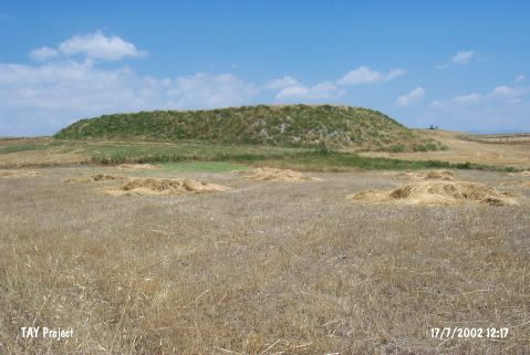
Külhöyük |
||||||
|
|
||||||
| Ages | Maps | Photos | ||||
| EBA |
 |
 |
||||
|
|
||||||
|
Type:
|
Mound | |||||
|
Altitude:
|
645 m | |||||
|
Diameter:
|
85 m- Direction: S-N | |||||
|
|
||||||
|
Region:
|
Central Anatolia | |||||
|
Province:
|
Çorum | |||||
|
District:
|
Iskilip | |||||
|
Village:
|
Kayaagzi | |||||
|
|
||||||
|
Destruction :
|
Illicit Digging - Agriculture | |||||
|
|
||||||
|
TAYEx:
|
Visited - 17/7/2002 | |||||
|
|
||||||
|
Registration State:
|
For detailed registration information please refer to Turkish pages. | |||||
 |
||||||
| Location: |
| Geography and Environment: |
| Destruction Details: The mound has been damaged by agricultural activities and illicit digging. Soil has been taken from its eastern slope; northeast section has been cut and its skirts have been leveled. There are pits on top hill [TAYEx 17.7.2002]. |