|
©The Archaeological Settlements of Turkey - TAY Project
|
|
|
|
|
|
Külhöyük |
|
|
For site maps and drawings please click on the picture...  |
For photographs please click on the photo... 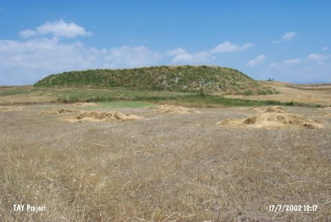 |
|
Type:
|
Mound |
|
Altitude:
|
645 m |
|
Region:
|
Central Anatolia |
|
Province:
|
Çorum |
|
District:
|
Iskilip |
|
Village:
|
Kayaagzi |
|
Investigation Method:
|
Survey |
|
Period:
|
|
|
|
|
 |
|
| It lies about 2 km south of Padisah Tepesi Höyügü within the territory of Kayaagzi Village; northern bank of the Kizilirmak River; west of Çorum Province. In order to reach the mound it is needed to go 3.8 km on Çorum-Çankiri motorway and go on for 4.5 km with the dirt road opposite the abandoned gas station. It is a very flat mound. It measures 2.3 m in height and 100x150 m in dimensions. The side overlooking the village road has been demolished almost to the level of the road due to continuous ploughing. The foothill has been spreaded onto a wide area. It was documented in 1996 by T. Sipahi and T. Yildirim. The surface collection yielded restricted numbers of sherds dating from the Classical Period and plenty of sherds dating from the EBA. |
| Location: |
| Geography and Environment: |
| History: |
| Research and Excavation: |
| Stratigraphy: |
| Small Finds: |
| Remains: |
| Interpretation and Dating: |