| ©The Archaeological Settlements of Turkey - TAY Project | ||||||
|
|
||||||
Küçük Hedbe |
||||||
|
|
||||||
| Ages | Maps | Photos | ||||
| Neolithic Chalcolithic EBA IA |
 |
 |
||||
|
|
||||||
|
Type:
|
Mound | |||||
|
Altitude:
|
470 m | |||||
|
Diameter:
|
m- Direction: | |||||
|
|
||||||
|
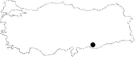
Region:
|
Southeastern Anatolia | |||||
|
Province:
|
Sanliurfa | |||||
|
District:
|
Harran | |||||
|
Village:
|
Seferköy | |||||
|
|
||||||
|
Destruction :
|
Contemporary Settlements | |||||
|
|
||||||
|
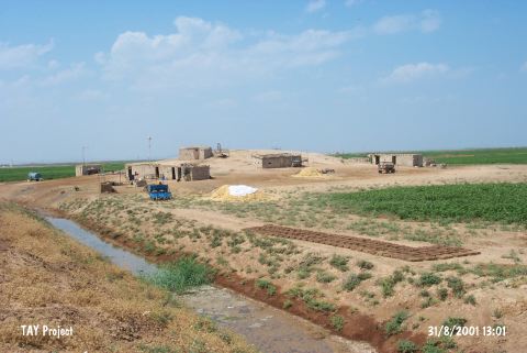
TAYEx:
|
Visited - 31/8/2001 | |||||
|
|
||||||
|
Registration State:
|
Registered For detailed registration information please refer to Turkish pages. | |||||
 |
||||||
| Location: The site lies 700 m northwest of Büyükhedbe; 9 km south of the district of Harran (Altinbasak); south-southeast of the center of Sanliurfa. Büyükhedbe and Küçükhedbe were noted reverse. |
| Geography and Environment: There is not enough information about its location. It is reported that the mound is in the Harran plain; and measures 115 m in diameter and 6 m in height. It is also mentioned that because of the surrounding fertile fields and plowing the mound is in danger of destruction. |
| Destruction Details: There are mudbrick houses on top and the slopes of the mound [TAYEx 31.8.2001]. |