| ©The Archaeological Settlements of Turkey - TAY Project | ||||||
|
|
||||||
Kumartepe |
||||||
|
|
||||||
| Ages | Maps | Photos | ||||
| Neolithic 14C |
 |
 |
||||
|
|
||||||
|
Type:
|
Flat Settlement | |||||
|
Altitude:
|
415 m | |||||
|
Diameter:
|
m- Direction: | |||||
|
|
||||||
|
Region:
|
Southeastern Anatolia | |||||
|
Province:
|
Sanliurfa | |||||
|
District:
|
Bozova | |||||
|
Village:
|
Igdeli | |||||
|
|
||||||
|
Destruction :
|
Dams | |||||
|
|
||||||
|
TAYEx:
|
Not visited - 29/8/2001 | |||||
|
|
||||||
|
Registration State:
|
For detailed registration information please refer to Turkish pages. | |||||
 |
||||||
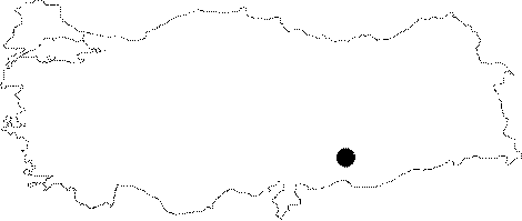
| Location: This site is northwest of Sanliurfa Province; northeast of the village of Dutluca and Yaylak County and north of the village of Igdeli (Saskan). The mound has been flooded by the Atatürk Dam Lake. |
| Geography and Environment: Before the Atatürk Dam Lake was built; the site was located on the southern bank of the Euphrates; east of where Incesu Stream emptied into the Euphrates and between the mound sites of Büyük and Küçük Saskan. The local inhabitants of the village of Saskan used to call this area "Arudha" Arabic for "the place between two places". The finds collected during the surface survey conducted on the mound in 1982 were puzzling; it could not be ascertained whether there was pre-Halaf and pre-Early Chalcolithic; Neolithic habitation at the site. Since finding Neolithic remains in an archaeological excavation at the mound would have been a gamble; this mound was called Kumartepe; literally "gamble-hill". The northern part of this site has been eroded by the Euphrates; just like the northern parts of the two Saskan mounds on either side. The western part of the site and the Küçük Saskan mound have been damaged by a ditch. The eastern part of the site is bounded by a small stream. The ditch may be an earlier meander of the Incesu Stream. The surface survey conducted on Kumartepe determined that the site is flat and approximately 350x200 m in size; covering an area of about 4.8 ha. The cultural deposit is 2.5 m deep. It is wrong to call this flat open-air site "tepe" or mound. |
| Destruction Details: The site is flooded by dam reservoir today [TAYEx 29.8.2001]. |