|
©The Archaeological Settlements of Turkey - TAY Project
|
|
|
|
|
|
Kumartepe |
|
|
For site maps and drawings please click on the picture... 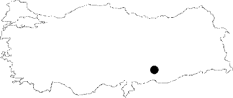 |
For photographs please click on the photo...  |
|
Type:
|
Flat Settlement |
|
Altitude:
|
415 m |
|
Region:
|
Southeastern Anatolia |
|
Province:
|
Sanliurfa |
|
District:
|
Bozova |
|
Village:
|
Igdeli |
|
Investigation Method:
|
Excavation |
|
Period:
|
Ceramic |
|
|
|
 |
|
| Location: This site is northwest of Sanliurfa Province; northeast of the village of Dutluca and Yaylak County and north of the village of Igdeli (Saskan). The mound has been flooded by the Atatürk Dam Lake. |
| Geography and Environment: Before the Atatürk Dam Lake was built; the site was located on the southern bank of the Euphrates; east of where Incesu Stream emptied into the Euphrates and between the mound sites of Büyük and Küçük Saskan. The local inhabitants of the village of Saskan used to call this area "Arudha" Arabic for "the place between two places". The finds collected during the surface survey conducted on the mound in 1982 were puzzling; it could not be ascertained whether there was pre-Halaf and pre-Early Chalcolithic; Neolithic habitation at the site. Since finding Neolithic remains in an archaeological excavation at the mound would have been a gamble; this mound was called Kumartepe; literally "gamble-hill". The northern part of this site has been eroded by the Euphrates; just like the northern parts of the two Saskan mounds on either side. The western part of the site and the Küçük Saskan mound have been damaged by a ditch. The eastern part of the site is bounded by a small stream. The ditch may be an earlier meander of the Incesu Stream. The surface survey conducted on Kumartepe determined that the site is flat and approximately 350x200 m in size; covering an area of about 4.8 ha. The cultural deposit is 2.5 m deep. It is wrong to call this flat open-air site "tepe" or mound. |
| History: |
| Research and Excavation: The mound was discovered by T.J. Wilkinson in 1982 during the regional archaeological and geomorphological studies of the Kurban Höyük excavations. Excavations were begun shortly after; in 1983; since the sherds found suggested Neolithic dates. These excavations were conducted jointly by the Dutch Historical and Archaeological Institute; the University of Chicago; Oriental Institute and the Sanliurfa Museum. S. Bedri-Baykan together with the Hayaz Höyük team joined the excavations led by J. Roodenberg. 7 small deep-sounding-like test-trenches were opened in different parts of the site and along the profile carved out by the Euphrates. |
| Stratigraphy: The stratigraphy of the site was unearthed in the 20 m long trench on the Euphrates bank. It was determined that the cultural depositional deposit at the site was approximately 2.5-3 m deep. There are roughly two phases at the site. The Upper Phase: The upper 1-1.5 m thick deposit in all trenches yielded very few chipped stone tools or pottery. Post-Neolithic ceramics were found in the upper 50-80 cm of this layer. The soil in the lower part of this layer is grayish sandy soil. The finds are mixed. The Lower Phase: This phase comprises the bottom 1.5 m above virgin soil. Some material cultural finds were unearthed in this layer as well. Excavation revealed that the depositional fill was not as deep in some parts of the site. |
| Small Finds: Architecture: No architectural remains were found in the upper phase and the lower phase yielded very little. In situ material was found on pebble floors in trench S along the Euphrates. It is clear that these floors are man made and not natural since some of the lining stones were broken into appropriate shapes before being used. The corner of a limestone house foundation found in another trench; mudbrick collapse and paved floors all indicate that there was indeed habitation at this site. An oven fragment and a earth floor were found in Trench E. A village plan could not be discerned since the trenches were small and the houses were spread apart. Pottery: Analysis determined that there are two types of Neolithic wares at the site. One is a hand-made; chaff or mineral tempered; buff colored coarse ware while the other is well-fired mineral tempered; hand-made; buff-gray colored fine ware. In addition to these main types; red slipped; sand-tempered ware and plain unburnished; fine paste ware was found. Buff ware with red vertical striped decoration was present in low numbers. The same vessel shapes are used in all ware types. Some of these vessel shapes include vessels with protruding pierced mouths and pierced horizontal and vertical lugs as well as out turned lipped bowls and dishes. Chipped Stone: Flint is the raw material used in these types of tools. Obsidian comprises only 2% of all the chipped stone finds. 15% of the assemblage are tools while the remaining is debitage products. Flakes and blades have been found in equal ratios. Flat backed Neolithic points and lanceheads; burins; scrapers on flakes; a few sickle blades; perforators and drill bits are the most common tool types [Grace 1990-90:145-155]. Prismic or pyramidal small cores have also been found [Roodenberg 1985:4]. It is believed that pebble-tools were used in blade production. Thousands of small perforators used in bead production were found in the trench along the bank of the Euphrates [Roodenberg 1989:97]. The Neolithic inhabitants of this site must have used the coarse amorphous flint cores along the Euphrates as their raw material for tool production. Ground Stone: Very few stone bowl fragments were found in different trenches. These are thick-walled; simple limestone bowls. Grinding stones and celts clearly suggest that the Neolithic habitation at this site was not seasonal. A few limestone human figurines (about 5.5 cm in height) were found. Bone/Antler: Not much information has been provided on this artifact category; although bone tools are reported to have been found. |
| Remains: |
| Interpretation and Dating: Roodenberg; Director of the Kumartepe excavations; believes the upper layer with no architectural remains is related to the Büyük and Küçük Saskan mounds on each side. The lower level; which continues down to virgin soil; on the other hand;is believed to be contemporaneous with Amuq A and B types as well as Turlu and the Mersin Yumuktepe Neolithic levels. The carbon dates collected from the trench along the Euphrates is dated to uncalibrated 7.930 ± 80 BP. The lowest level of Kumartepe; therefore; has been assigned to the first half of the sixth millennium BC. |