| ©The Archaeological Settlements of Turkey - TAY Project | ||||||
|
|
||||||
Kum Ocagi |
||||||
|
|
||||||
| Ages | Maps | Photos | ||||
| Chalcolithic |
 |
 |
||||
|
|
||||||
|
Type:
|
Flat Settlement | |||||
|
Altitude:
|
335 m | |||||
|
Diameter:
|
m- Direction: | |||||
|
|
||||||
|
Region:
|
Southeastern Anatolia | |||||
|
Province:
|
Gaziantep | |||||
|
District:
|
Nizip | |||||
|
Village:
|
Gürçay | |||||
|
|
||||||
|
Destruction :
|
Dams - Mines/Quarries | |||||
|
|
||||||
|
TAYEx:
|
Not found - 17/8/2001 | |||||
|
|
||||||
|
Registration State:
|
For detailed registration information please refer to Turkish pages. | |||||
 |
||||||
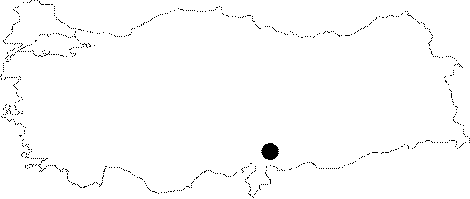
| Location: The site is located southeast of Gaziantep and the district of Nizip; 1.2 km south of Gurcay (Girlavik) Village. |
| Geography and Environment: The site lies on the Holocene Period terrace of the west bank of Euphrates. The present sections suggest a cultural deposit of 1 Ğ 1.5 m for this site that lies across Tiladir Tepe. It is a 420x150 m settlement; covering an area of 6.3 hectares; probably with only one phase. The cultural deposit is severely damaged since 1989; when it was first discovered; due to taking away sand and gravel for the construction of Hancagiz Dam. |
| Destruction Details: The natural view of the quarry which the settlement is located is completely vanished and the topography of the field has been changed. There is a possibility of the site is flooded by the dam reservoir. The exact location of the site can not be found today [TAYEx 17.8.2001]. |