| ©The Archaeological Settlements of Turkey - TAY Project | ||||||
|
|
||||||
Kocahöyük Batisi |
||||||
|
|
||||||
| Ages | Maps | Photos | ||||
| Palaeolithic/Epipalaeolithic |
 |
 |
||||
|
|
||||||
|
Type:
|
Habitation Site / Workshop | |||||
|
Altitude:
|
820 m | |||||
|
Diameter:
|
m- Direction: | |||||
|
|
||||||
|
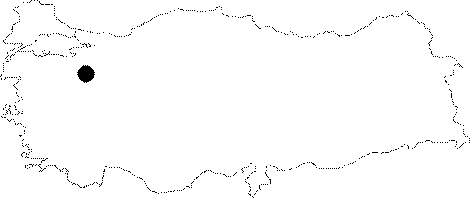
Region:
|
Aegean | |||||
|
Province:
|
Kütahya | |||||
|
District:
|
Domaniç | |||||
|
Village:
|
Çakilköy | |||||
|
|
||||||
|
Destruction :
|
Agriculture | |||||
|
|
||||||
|
TAYEx:
|
Visited - 3/7/2004 | |||||
|
|
||||||
|
Registration State:
|
For detailed registration information please refer to Turkish pages. | |||||
 |
||||||
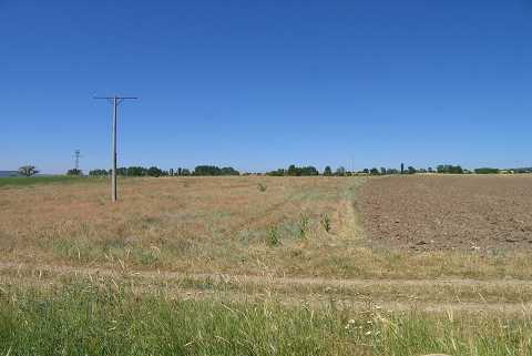
| Location: This site lies in the province of Kütahya; northwest of the city; 2 km; as the crow flies; southeast of the town of Domaniç; west of Kocahöyük Tepe and the village of Çakilköy. |
| Geography and Environment: The western fields the site lie on are very close to the large Kocahöyük mound. There is a small stream flowing by this habitation site. The finds are scattered in an area with a radius of approximately 300 m. |
| Destruction Details: The surface of the find spot is planted and a tractor road passes from the east of it [TAYEx 3.7.2004]. |