| ©The Archaeological Settlements of Turkey - TAY Project | ||||||
|
|
||||||
Ani |
||||||
|
|
||||||
| Ages | Maps | Photos | ||||
| Palaeolithic/Epipalaeolithic IA |
 |
 |
||||
|
|
||||||
|
Type:
|
Single Findspot | |||||
|
Altitude:
|
1480 m | |||||
|
Diameter:
|
m- Direction: | |||||
|
|
||||||
|
Region:
|
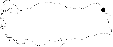
Eastern Anatolia | |||||
|
Province:
|
Kars | |||||
|
District:
|
Merkez | |||||
|
Village:
|
Ocakli | |||||
|
|
||||||
|
|
||||||
|
|
||||||
|
TAYEx:
|
Visited - 30/6/2003 | |||||
|
|
||||||
|
Registration State:
|
For detailed registration information please refer to Turkish pages. | |||||
 |
||||||
| Location: This open-air site is 42 km (as the crow flies) east-southeast of the city of Kars. It lies northeast of the district of Digor; by the caves near the historic Ani ruins and close to the stream. The village of Ocakli (Ani). |
| Geography and Environment: The streamlet mentioned by Kökten springs from the eastern slopes of 2;670 m high Mount Alaca and flows by the Ani ruins where it joins Arpaçay. Although he does not describe them; Kökten informs us of the existence of nearby caves. Indeed; a 1:100;000 map indicates that caves are abundant in this area. It is not reported whether the finds are surface finds. |
| Destruction Details: |