|
©The Archaeological Settlements of Turkey - TAY Project
|
|
|
|
|
|
Ani |
|
|
For site maps and drawings please click on the picture... 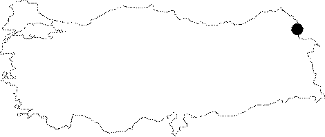 |
For photographs please click on the photo...  |
|
Type:
|
Single Findspot |
|
Altitude:
|
1480 m |
|
Region:
|
Eastern Anatolia |
|
Province:
|
Kars |
|
District:
|
Merkez |
|
Village:
|
Ocakli |
|
Investigation Method:
|
Survey |
|
Period:
|
|
|
|
|
 |
|
| It lies close to a stream in front of the caves near the ancient settlement of Ani in the Ani Village (current name Ocakli) northeast of the Digor District, 42 km east-southeast of Kars as the crow flies. The stream which originates from the eastern skirts of the Mound Alaca with a summit of 2.670 m joins with Arpacay near the ruins. This should be the stream referred by Kökten with no name. Although Kökten mentions the presence of natural caves near the stream, no further information is provided about the caves. Ani was under the rule of Tsardom of Russia between 1878 and 1918. It was during this period, in 1892, that the first excavation at the city was launched by N. Marr [Uluslararasi Dördüncü Türk Kültürü Kongresi Bildirileri]. During the survey conducted around the ruins of Ani by I.K. Kökten in 1942, a chipped stone tool was found. K. Balkan excavated the site in 1965. B. Karamagarali launched systematic excavations at Ani in 1991and carried out the excavations until 2005. In 2006, H. Gündogdu led the excavations for a year. Between 2007 and 2009 Y. Çoruhlu was the site director at Ani. From 2012 to 2014, the Directorate of Kars Museum was in charge of the excavations. Since 201, F. Bayram has been leading the excavations at Ani. The longest excavations at Ani took place in the ruins. Three different places were excavated; mosque, baths and skirts of the citadel. The mosque rests on the steep slope of the Arpacay Valley on the left side of the present road running from Arslanli Kapi (Lion Gate) to the Ic Kale (Citadel) at Orta Ani. Although it appears in ruins, the foundation walls are in good condition. The Bath is located toward Arpacay on the left side of the road leading from the gateway of the fortress to Iç Kale. The finds at Ani are concentrated in three sites, which are Cirittepe, Harmanyeri and Ani Ruins. Cirittepe includes several stone structures, among them a 205 cm high tower calls attention. The finds at Harmanyeri includes five tone graves and two stone cellars as well as various ceramic vessels. As it is located in front of the village as threshing field (harmanyeri), it doesn't give an impression of a cemetery despite of partial levelling activities. The present cemetery is also located here. As a result of excavations, it is concluded that rich amount and forms of ovens at level I resemble the ovens of the Urartu Period called Level 1 at Degirmentepe, Patnos. Some other vessels bearing various motifs were also found at Ani, and they are important as they were not found at Altintepe, Erzincan in the level of the Urartu Period. Thus, such vessels are dated to the late Urartu Period or a successive era. The Ani Ruins have been scattered to a very wide area, being inhabited during each era of the history. Therefore, they house architectural buildings reflecting characteristics of many periods. |
| Location: This open-air site is 42 km (as the crow flies) east-southeast of the city of Kars. It lies northeast of the district of Digor; by the caves near the historic Ani ruins and close to the stream. The village of Ocakli (Ani). |
| Geography and Environment: The streamlet mentioned by Kökten springs from the eastern slopes of 2;670 m high Mount Alaca and flows by the Ani ruins where it joins Arpaçay. Although he does not describe them; Kökten informs us of the existence of nearby caves. Indeed; a 1:100;000 map indicates that caves are abundant in this area. It is not reported whether the finds are surface finds. |
| History: |
| Research and Excavation: |
| Stratigraphy: |
| Small Finds: |
| Remains: |
| Interpretation and Dating: |