| ©The Archaeological Settlements of Turkey - TAY Project | ||||||
|
|
||||||
Kiriskal |
||||||
|
|
||||||
| Ages | Maps | Photos | ||||
| EBA |
 |
 |
||||
|
|
||||||
|
Type:
|
Mound | |||||
|
Altitude:
|
540 m | |||||
|
Diameter:
|
m- Direction: | |||||
|
|
||||||
|
Region:
|
Mediterranean | |||||
|
Province:
|
Gaziantep | |||||
|
District:
|
Islahiye | |||||
|
Village:
|
Kiriskal | |||||
|
|
||||||
|
Destruction :
|
Contemporary Settlements - Attention | |||||
|
|
||||||
|
TAYEx:
|
Visited - 26/8/2001 | |||||
|
|
||||||
|
Registration State:
|
Registered For detailed registration information please refer to Turkish pages. | |||||
 |
||||||
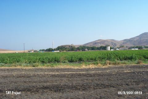
| Location: It is close to the village it was named after; 37 km northeast of the Islahiye District; northwest of the Gaziantep Province. It is located 25 km northeast of Zincirli. |
| Geography and Environment: It is situated in a very fertile part of the Sakçagözü Plain. It is a medium sized mound measuring 7 m in height and ca. 250x200 m in dimensions [Alkim 1974:fig.102]. |
| Destruction Details: All of the skirts of the mound are cut and there are village houses beginning from slopes and a water reservoir on top [TAYEx 26.8.2001]. |