|
©The Archaeological Settlements of Turkey - TAY Project
|
|
|
|
|
|
Kiriskal |
|
|
For site maps and drawings please click on the picture...  |
For photographs please click on the photo... 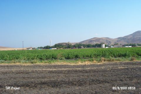 |
|
Type:
|
Mound |
|
Altitude:
|
540 m |
|
Region:
|
Mediterranean |
|
Province:
|
Gaziantep |
|
District:
|
Islahiye |
|
Village:
|
Kiriskal |
|
Investigation Method:
|
Excavation |
|
Period:
|
EBA III |
|
|
|
 |
|
| Location: It is close to the village it was named after; 37 km northeast of the Islahiye District; northwest of the Gaziantep Province. It is located 25 km northeast of Zincirli. |
| Geography and Environment: It is situated in a very fertile part of the Sakçagözü Plain. It is a medium sized mound measuring 7 m in height and ca. 250x200 m in dimensions [Alkim 1974:fig.102]. |
| History: |
| Research and Excavation: The architectural remains uncovered during an illicit digging carried out by the local villagers in 1966 were informed to U.B. Alkim who was conducting an excavation in Gediz located 5 km away from Kiriskal. He carried out a survey followed by excavations in 1967 and 1970 which yielded architectural remains related with the underground structure of the mound. It takes place in the registered archaeological sites list prepared by Ministry of Culture and Tourism. |
| Stratigraphy: Due to lack of information about the surface finds of Kiriskal Höyük; no stratification was done. |
| Small Finds: Architecture: An underground street; 70-75 m wide; 170-180 cm high and 27.5 m long; was recovered on the eastern foothill. The tunnel continues a while farther in the east direction; and then directs to the northeast ending in a small chamber went down with three steps carved into the bedrock just like the chamber itself. The other end of the tunnel street is closed with rough stones. As construction technique; lateral walls get closer from down to up by overlapping techique; the street gets narrower upward and it is capped by big stone plates. Big plates are also observed on the lateral walls [Alkim 1974:section at fig 103]. |
| Remains: |
| Interpretation and Dating: No excavation was carried out at the settlement of Kiriskal Höyük. Only significant find uncovered is the tunnel identified as a cult place of the god of underground. It is compared with the M4 structure of Gedikli (sacred tunnel) by U.B. Alkim who proposes to date it to EBA III and MBA I based on this comparison only [Alkim 1983:175]. Therefore; it is not a certain EBA site. Another surface collection is necessary. |