| ©The Archaeological Settlements of Turkey - TAY Project | ||||||
|
|
||||||
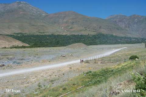
Kildirik / Küçüktepe |
||||||
|
|
||||||
| Ages | Maps | Photos | ||||
| EBA |
 |
 |
||||
|
|
||||||
|
Type:
|
Mound | |||||
|
Altitude:
|
1320 m | |||||
|
Diameter:
|
103 m- Direction: NW-SE | |||||
|
|
||||||
|
Region:
|
Eastern Anatolia | |||||
|
Province:
|
Erzincan | |||||
|
District:
|
Üzümlü | |||||
|
Village:
|
Üzümlü | |||||
|
|
||||||
|
Destruction :
|
Natural causes | |||||
|
|
||||||
|
TAYEx:
|
Visited - 24/6/2003 | |||||
|
|
||||||
|
Registration State:
|
Registered For detailed registration information please refer to Turkish pages. | |||||
 |
||||||
| Location: |
| Geography and Environment: |
| Destruction Details: The skirts of the settlement are being eroded by the stream [TAYEx 24.6.2003]. |