| ©The Archaeological Settlements of Turkey - TAY Project | ||||||
|
|
||||||
Keferdiz |
||||||
|
|
||||||
| Ages | Maps | Photos | ||||
| Palaeolithic/Epipalaeolithic |
 |
 |
||||
|
|
||||||
|
Type:
|
Single Findspot | |||||
|
Altitude:
|
m | |||||
|
Diameter:
|
m- Direction: | |||||
|
|
||||||
|
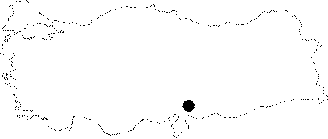
Region:
|
Mediterranean | |||||
|
Province:
|
Gaziantep | |||||
|
District:
|
Nurdagi | |||||
|
Village:
|
Sakçagözü | |||||
|
|
||||||
|
|
||||||
|
|
||||||
|
TAYEx:
|
Not visited - 26/8/2001 | |||||
|
|
||||||
|
Registration State:
|
Registered For detailed registration information please refer to Turkish pages. | |||||
 |
||||||
| Location: This site is between Coba Höyük and the town of Keferdiz (also called Sakçegözü); 45 km northwest of the city of Gaziantep; in the northwest of the province. |
| Geography and Environment: Perrot has not described the geographical setting of this site. There are three mounds in this part of Gaziantep on the Islahiye Plain; which borders the southern Anatolian "Mediterranean" Region. These mounds include Songrus Höyük to the west; Keferdis Höyük to the east and Coba Höyük in the middle. Of these three mounds; Keferdiz is archaeologically the least important. The area is rich in water sources. |
| Destruction Details: |