| ©The Archaeological Settlements of Turkey - TAY Project | ||||||
|
|
||||||
Kayaönü Mevkii |
||||||
|
|
||||||
| Ages | Maps | Photos | ||||
| Palaeolithic/Epipalaeolithic |
 |
 |
||||
|
|
||||||
|
Type:
|
Single Findspot | |||||
|
Altitude:
|
m | |||||
|
Diameter:
|
m- Direction: | |||||
|
|
||||||
|
Region:
|
Southeastern Anatolia | |||||
|
Province:
|
Gaziantep | |||||
|
District:
|
Merkez | |||||
|
Village:
|
Ibrahimli | |||||
|
|
||||||
|
|
||||||
|
|
||||||
|
TAYEx:
|
Not visited - 20/8/2001 | |||||
|
|
||||||
|
Registration State:
|
For detailed registration information please refer to Turkish pages. | |||||
 |
||||||
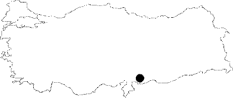
| Location: Although it is unclear; in the map published by Çiner this site appears to be northwest of the city of Gaziantep. Above we have tried to place the site in an approximate location near Kayali Tepe. |
| Geography and Environment: There are many vineyards in this region; which is fertile because of the Sulu Dere Stream. The site is now threatened by the suburbs of the growing city of Gaziantep. |
| Destruction Details: |