| ©The Archaeological Settlements of Turkey - TAY Project | ||||||
|
|
||||||
Loryma |
||||||
|
|
||||||
| Ages | Maps | Photos | ||||
| Greek-Roman |
 |
 |
||||
|
|
||||||
|
Type:
|
City | |||||
|
Altitude:
|
m | |||||
|
Diameter:
|
m- Direction: | |||||
|
|
||||||
|
Region:
|
Aegean | |||||
|
Province:
|
Mugla | |||||
|
District:
|
Marmaris | |||||
|
Village:
|
Bozuk | |||||
|
|
||||||
|
|
||||||
|
|
||||||
|
TAYEx:
|
- | |||||
|
|
||||||
|
Registration State:
|
For detailed registration information please refer to Turkish pages. | |||||
 |
||||||
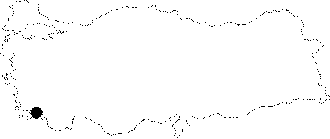
| Location: It is located at the present Bozuk to the southwest of the Marmaris District of the Mugla Province. It is situated on the western end of the Carian Chersonese known as Loryma or Daracya Peninsula [Held 1997:171]. |
| Geography and Environment: The city became an important trade center between the Eastern Mediterranean and the Aegean Seas; as it had a large cove and a big and natural harbor at the Cape of Karaburun [Held 1997:173]. |
| Destruction Details: |