|
©The Archaeological Settlements of Turkey - TAY Project
|
|
|
|
|
|
Loryma |
|
|
For site maps and drawings please click on the picture... 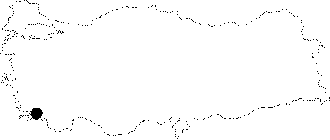 |
For photographs please click on the photo...  |
|
Type:
|
City |
|
Altitude:
|
m |
|
Region:
|
Aegean |
|
Province:
|
Mugla |
|
District:
|
Marmaris |
|
Village:
|
Bozuk |
|
Investigation Method:
|
Excavation |
|
Period:
|
Archaic Classical Hellenistic Roman |
|
|
|
 |
|
| Location: It is located at the present Bozuk to the southwest of the Marmaris District of the Mugla Province. It is situated on the western end of the Carian Chersonese known as Loryma or Daracya Peninsula [Held 1997:171]. |
| Geography and Environment: The city became an important trade center between the Eastern Mediterranean and the Aegean Seas; as it had a large cove and a big and natural harbor at the Cape of Karaburun [Held 1997:173]. |
| History: It is believed that Loryma might have appeared at earliest since the 7th century BC. No exact data is available about the political status of the peninsula until the 4th century BC. According to Stephanus Byzantinus; Loryma was called as polis during the 6th century BC; and as harbor or locus in the following years. It is presumed that it was independent until the 4th century BC. Starting with the same century; the peninsula became under the control of Rhodes as a part of the Rhodian Peraea. The other cities along the peninsula became demoses of Rhodes; while Loryma was incorporated to the neighboring city of Casara. According to Diodoros; 1000 ships gathered at Loryma under the command of Demetrios Poliorketes in 305 BC; and besieged Rhodes [Held 1997:172-173]. The Treaty of Apameia in 167 BC put an end to the dominance of Rhodes in the region. The abandonment of Loryma during the Late Hellenistic Period is explained by a big erosion due to the destruction of the woods around the city [Held 2002:196]. |
| Research and Excavation: Surveys were conducted by Held in 1995; and 1998-2000. |
| Stratigraphy: |
| Small Finds: |
| Remains: As a result of the analyses on the potsherds recovered in the city; it is concluded that the city had been inhabited from the 7th century BC until the end of the Hellenistic Period. It covers an area of 16.000 square meters including the acropolis; and the length from northwest to southeast is 270 m [Held 2000:295]. In the acropolis; there are three cisterns and remains of a building; probably of a house. The acropolis presumably used for sheltering in case of an emergency yielded potsherds during surface collections with a variety ranging from the Archaic to the Roman Imperial Periods [Held 1997:174]. There are two public buildings in the residential area of lower city; one is probably the stoa; and the other is the municipality building. No sanctuary was found inside the city wall [Held 2000:295]. City Wall: It consists of two phases. The walls built of polygonal limestone blocks in the first phase can be traced in the southern and southwestern sections of the city. The second phase partially stands on the first phase. The features of the wall from the early phase is compared to the early phase of the Neandria wall; and to the Lelegian settlements on the Peninsula of Halicarnassus. The second-phase walls consisting of trapezoid and polygonal blocks were built in front of the first-phase walls; therefore the borders of the city were enlarged. Only two of the rarely available towers have been preserved. Based on the ruins; the main gate might have been located to the southwest. The entrance of the gate; large enough to allow access of cars; is from the side. The wall found to have four more small-sized entrances; have similarities with the walls of Latmos and Halicarnassus so that the second phase is dated to the 5th or 4th century BC. The tower to the northwest of the acropolis is a developed sample of the tower construction techniques and have similarities with the construction techniques of the Harbor Fortress. The tower; constituting a third phase in this respect; is dating from the Early Hellenistic Period along with the Harbor Gate [Held 2000:295-296]. The structure called the Harbor Fortress overlooking the entrance of the bay to the southwest of the city was pierced by two large rounded towers; and rectangular towers. The information on the rock inscriptions at the southern end revealed that it was an altar dedicated to Zeus Atabyrios. Based on this; the researchers suggest that the fortress might have been built by Rhodians. It is proposed that it can be dated to the 4th century BC on the basis of the masonry and the potsherds obtained during the surface collection [Held 1997:175]. A building was found on the eastern side of the Loryma Bay at the southern-most tip; on a cape adjacent to the entrance of the bay. As the locals believe that it should have been a windmill; they called the cape "Degirmen Burnu" (Cape Mill). As a big building with a rounded plan; it was built from calcerous blocks with a rough polygonal block technique. It is reported that it may have been a watchtower when the plan; the location; and the Harbor Fortress accross are taken into consideration. It is likely that it might have been built along with the Harbor Fortress by Rhodians during the early 3rd century BC [Held 2002:193]. Researches to the north and west of the city yielded a "ring-wall" type of fortress on a round hill. It was called "The Sheltering Fortress" by the researchers. The wall with a nearly circular plan was erected of rough rubble stones. The width is 2.4 m; with a preserved height of approximately 1.4 m. The upper part was presumed to be of mudwall. A gate was found to the east side as well as traces of the foundation of an oval planned tower; possibly used for watching and sending signs; at the top within the area enclosed by the wall. One of the five buildings found on the slopes has an apse. It is reminiscent of the settlement of Emporio in the Chios island based on the individual and scattered construction. The apsed structure; and the oval structure can be dated to the 8th-7th century BC based on their plan. The potsherds on the surface are dated to the period between the Archaic and Hellenistic Periods. The so-called fortress type structure is thought to be similar to Carian or Lelegian type "ringwall" structures; with a rough circular plan and without any towers or bastions common at the Sodra Mountain in Mylasa and in the Latmos region. It is also compared to the Lelegs' shelter forts in the vicinity of Halicarnassus. The researcher believes that the shelter fort might have been used by Carians as it was close to the settlements in Loryma and the Asar Mountain. It was also suggested that closeness of the settlement with the sheltering fort may have been related with a differentiation between the people of the city; and the people of the suburbs [Held 2003:294]. Temple/Sanctuary: The Sanctuary of Artemis Pergaia: It is located below the necropolis to the southwest of the city. A statue of the mother goddess was probably standing on the bench produced by carving the rock at the center of the Sacred Area; located among rocks. The name Artemis Pergaia is referred in an inscription on the rocks. As known from an epitaph; there is a cult in Loryma belonging to that goddess [Held 2000:296]. The Sanctuary of Artemis Soteira: The remains found in a plain to the west of the city possibly belong to the sanctuary of Artemis Soteira [Held 1997:173]. Among those finds dating to the 4th-3rd century BC; the lion headed cyma made of limestone from the Hellenistic Period possibly belongs to a stoa. It is presumed that a church was built on the sanctuary during the Byzantine Period. Thus; no precise information is available about the sacred area [Held 1997:174]. The Sanctuary of Apollo: It lies at so called "Lumbükü" of the bay. The earliest find is a relief base from the Archaic Period. A foundation from the Early Hellenistic Period was uncovered as archaeological remains. Besides the pedestals of bronze statues and other votives; many fragments of marble water vessels were unearthed. The potsherds are dated to the 6th - 3rd centuries BC. It was found out that constructions continued even during the Byzantine Period. The Sanctuary of Kybele: Two sanctuaries were found at the place so called the Kybele Brook. The bigger one with a rock-niche shape is situated on the northern slope of the Kybele Brook. The rectangular niche was carved into the rock; and given a circular shape to the top. Probably there was a relief inside the niche. There is a terrace with three-row blocks constructed in front of the niche surrounded by a door carved into the rock. Among the ruins found around it; there is a rock bowl carved into the rock above the cult niche. There is a chamber opened below that bowl; and on the western side of the chamber there is a waterproof plaster on the external surface of the wall. Further downwards there are two cisterns. Although no inscriptions were found; presence of the rock niche is an indication of Kybele; the Anatolian goddess. It is reported that other remains; which seem to be related with water; might have been related with Kybele [Held 2001:155-156]. Residences: The houses consisting of one or two rooms were designed in small dimensions. Some with courtyards; they were generally built adjacent to each other. The bedrock was used for the construction of houses. The Loryma houses unlike the house types in the neighboring cities; are reminiscent of the Latmos houses at the Bafa Lake; which were abandoned around 300's BC; in respect to their plan and dimensions. Peschlow believes that those houses are of a common feature of the Carian Culture. Necropolis/Graves: The necropolis of the city stretches from the west side of the bay to the south [Held 1997:173]. There are terraced graves; and stepped pedestals specific to the Loryma peninsula along the ancient road between the Sanctuary of Apollo and the Necropolis [Held 1997:174]. The most magnificent type among the graves found at Loryma are the terraced graves made of stone blocks. A few pedestals and monumental graves stand on the terraces in this type of graves [Held 2001:153]. Besides; a majority of the monumental graves were constructed on the limestone bases. Inside one of the graves; there is a grave stele or a statue in the form of a naiskos [Held 2001:154]. The grave altars with upper and lower profiles are dated to the 4th to 2nd centuries depending on the finds unearthed [Held 2001:154]. The sample; classified as Grave 3 by the researchers; is among the best preserved ones. The underground chamber of the grave consisting of pillow type blocks has been destructed by illicit diggings. Out of the five Carian Chersonesesian type of stepped grave bases; two were in situ on the terrace; and three were fallen in front of the terrace [Held 2000:297]. Most of the graves are underground chambers made of either limestone or sandstone. The graves where the dead were placed in normal position are probably dating from the 6th or 5th centuries BC [Held 2001:154]. Other types of graves in the Loryma necropolis include terra cotta or limestone osthoteks and amphoras; where the dead were placed after incineration. Two of those are dated to the 5th-4th centuries BC. Thus; both incineration and burial were common in the city. Comparison of this type of graves in Loryma as well as other cities in the peninsula with the ones in the necropolises of Cnidus and Rhodes indicates that some monumental tombs like rounded altars had been imitated [Held 2001:154]. Workshop: Farm: Some structures were found by the researchers; presumably farms at so called the "Kybele Brook" to the west of the Sanctuary of Apollo; and to the northwest of the city [Held 2001:155]. This is the most arable land of Loryma. The farms from the Hellenistic Period are located on the slopes [Held 2000:296]. In general; walls of the all farm structures are polygonal. Except for Farm #1; all yielded remains of a grape press. In the Farm #12; there are side structures alined around a large courtyard; and on the upper section there is the actual residence built of a better quality and bigger stone blocks compared to others. The walls are of polygonal blocks. To the immediate north of the farm building lies a cistern as well as a wine production facility to the west. In the Farm #6; all the buildings are lined up around the courtyard; with a wine press inside. The farm building is enclosed by a polygonal wall [Held 2001:155]. The Farm #1 is located on the northern slope of the plateau; close to the Sanctuary. It approximately covers an area of 1700 square meters. On two sides; it is protected by natural rocks; and by a polygonal wall toward the stream. There is a cistern to the southwest of the "L" shaped farm building; covering an area of 140 square meters [Held 2000:296-297]. The absence of a grape press only in the Farm #1 out of the 14 farm buildings found can be explained by re-use of the grinding stone plates of the farm for the construction of the Byzantine Period structures built on the Sanctuary of Apollo; which is very close to that farm [Held 2002:195]. The farm buildings are dated to the Hellenistic Period; and they are presumed to indicate a heavy wine production and export under the rule of Rhodes [Held 2001:155]. Almost all of them were abandoned during the 1st century BC. It is concluded that the terraces of the farm land were vineyards; and in these farms the grapes were pressed to produce wine. It is reported that under the rulership of Rhodes in Caria Chersonesos in 300 BC; the industrialized wine production began. The local people; i.e. Carians; worked in the farms of the peninsula. Also; workshops for amphora production were built to transport the wine. All this data is significant in showing that the Rhodian economy during the Hellenistic Period was highly dependent on the production and export of wine. Therefore; it is believed that Caria Chersonesos was incorporated into the Rhodian Peraea not only for military purposes but also for economical purposes [Held 2002:196]. Furthermore; a press bed carved into the monolite rock was found 30 m below the tower to the west of the military fortress (Harbor Fortress) [Diler 1995a:442-443]. Quarry: An ancient quarry was found to the north of the watchtower; east of the Loryma Bay. It was found out that brown and soft sandstone; which is easy to form; and which can easily dissolve out in the open air was obtained in the region so called "Kurekkellik". Two different techniques were used. In the first one; the blocks were individually removed from the rock; while the second involves cutting of the stones in a regular way; long; and parallel to the slope. The sandstone was used in the underground burial chambers and in the construction of magnificient building architecture by covering with a thin layer of plaster; and decorated with a colored dye. The same technique was used in Rhodes and the entire Caria Chersonesos (The Temple of Apollo Samnaios in Amos). The terrace walls to the north of the quarry might have been belonged to the residences of the workers of the quarry. The press stone in the residential area was probably used to grind olives. According to the researcher; two bases typical to Loryma graves show that a family permanently lived here. Three cisterns in addition to the grinding stone are among the finds. The analyses on potsherds and stones collected from the surface show that the quarry was used during the Hellenistic Period. It is also likely that it might have been used during the Classical Period as well [Held 2002:194]. |
| Interpretation and Dating: |