| ©The Archaeological Settlements of Turkey - TAY Project | ||||||
|
|
||||||
Latmos Herakleiasi |
||||||
|
|
||||||
| Ages | Maps | Photos | ||||
| IA Greek-Roman |
 |
 |
||||
|
|
||||||
|
Type:
|
City | |||||
|
Altitude:
|
m | |||||
|
Diameter:
|
m- Direction: | |||||
|
|
||||||
|
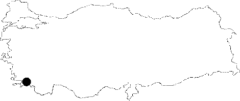
Region:
|
Aegean | |||||
|
Province:
|
Mugla | |||||
|
District:
|
Milas | |||||
|
Village:
|
Kapikiri | |||||
|
|
||||||
|
|
||||||
|
|
||||||
|
TAYEx:
|
- | |||||
|
|
||||||
|
Registration State:
|
Registered For detailed registration information please refer to Turkish pages. | |||||
 |
||||||
| Location: It is situated at Kapikiri; to the northwest of the Selimiye District of the Mugla Province. |
| Geography and Environment: The city is situated on a gradually heightening rocky land on a plateau [Peschlow 1986:155]. It is estimated that as the land was not very large; the economy was highly dependent on fishery. The position of Miletus right at the mouth of the gulf possibly produced a big disadvantage for Heracleia. The gulf gradually became a lake when it was silted up by the Meandros River. Thus; Heracleia's access to the sea was discontinued [Bean 2001:234]. The 1371 m high Latmos Mountain (Besparmak) has preserved its sanctity throughout the history. It became a place of seclusion. There are monasteries and spots for seclusion founded by clergymen [Bean 2001:239]. |
| Destruction Details: |