|
©The Archaeological Settlements of Turkey - TAY Project
|
|
|
|
|
|
Latmos Herakleiasi |
|
|
For site maps and drawings please click on the picture... 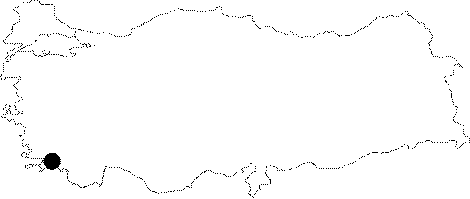 |
For photographs please click on the photo...  |
|
Type:
|
City |
|
Altitude:
|
m |
|
Region:
|
Aegean |
|
Province:
|
Mugla |
|
District:
|
Milas |
|
Village:
|
Kapikiri |
|
Investigation Method:
|
Survey |
|
Period:
|
Roman Hellenistic |
|
|
|
 |
|
| Location: It is situated at Kapikiri; to the northwest of the Selimiye District of the Mugla Province. |
| Geography and Environment: The city is situated on a gradually heightening rocky land on a plateau [Peschlow 1986:155]. It is estimated that as the land was not very large; the economy was highly dependent on fishery. The position of Miletus right at the mouth of the gulf possibly produced a big disadvantage for Heracleia. The gulf gradually became a lake when it was silted up by the Meandros River. Thus; Heracleia's access to the sea was discontinued [Bean 2001:234]. The 1371 m high Latmos Mountain (Besparmak) has preserved its sanctity throughout the history. It became a place of seclusion. There are monasteries and spots for seclusion founded by clergymen [Bean 2001:239]. |
| History: The Hittite-Luwian inscription discovered at the Suratkaya Hill with a 1000 m altitude in the Heracleia under Latmos proves the possibility of presence of a settlement even in 2000 BC [Peschlow 2003:261-264]. The city moved from Latmos to its new location during the second half of the 4th century BC; and was founded as Heracleia. The former city was used as a necropolis. The remains recovered during the researches up until now do not indicate any date earlier than the 4th century BC. Strabo [Strabo 14; 1; 8] and Stephanus Byzantinus provided information about the city. The city signed a treaty with Mylasa between 173-172 BC. Presumably maintaining its independence even after the 2nd century BC; the city lost its significance gradually after the Byzantine Period [McNicoll 1997:76-77]. |
| Research and Excavation: It was discovered by Chandler during his travels in Anatolia between 1764-65; and the first survey was carried out by Krischen in the 20th century; particularly providing signficant information about the city wall. The surveys supported by the German Research Institute between 1976-79; and by the German Archaeological Institute since 1984; have been currently conducted by Peschlow. It takes place in the registered archaeological sites list prepared by Ministry of Culture and Tourism. |
| Stratigraphy: |
| Small Finds: |
| Remains: Based on the information in the inscriptions; the territorium of Heracleia stretches from Myus to Ioniapolis in the northwest. A grill plan was used in the city; situated on a steep and rocky land. The agora in the center; the theater located above and to the east the agora were all built in grid plan [Akarca 1998:44]. Based on the nature of the land; the density of the settlement is partly heavily and partly loose. For constructions; rock was used as much as possible [Peschlow 1986:155-156]. Harbor: It has two harbors. They gradually lost their functionality because of the alluvions brought by the meander. One of the harbors was protected by a fortress with seven towers built on a rocky cape; and the other by the small island enclosed with a city wall; situated in front of the city [Akarca 1998:176]. City wall: The first wall built was approximately 6.5 km long. It was found that later on it was reduced by a diateichisma and became 4.5 km long. Granite was used for the construction of the walls. The wall built of stone blocks with an isodomic technique was erected onto the bedrock. The height of the wall is 5.5 m. The access to the promenade was provided by stairs. The thickness of the balustrade wall with a window is approximately 55-85 cm [McNicoll 1997:77-78; Akarca 1998:136; 140]. The square planned towers are mostly of two stories. They look alike the ones in Ephesus. The promenade is accessed by stairs after reaching the tower from the gate. There are holes in the lower story to throw arrows; while the larger war machines for throwing arrows and missiles were placed in the upper floor. One of the better preserved towers is 10x10 m in a square plan. The roof the towers are covered with tiles [McNicoll 1997:79-80]. 19 spots for gates were found. At least five of them are arched; and have lentos [McNicoll 1997:80]. The first phase of the walls is dated to the third quarter of the 4th century; however date of the second phase of the wall reduced by the diachetism is unknown as re-used material from the previous wall was employed for the construction [McNicoll 1997:77; Akarca 1998:197]. Agora: It is located in the center of the city; to the east of the Temple of Athena [Bean 2001:235-236]. It measures 60x100 m. The main entrance is from the east. There is another gate in the northwest; closer to the propylon of the Athena Temple. The floor is of gneiss. Fragments of marble stylobate were found especially in the west. Except for the northwestern corner; there are stylobate blocks. It is surrounded by galleries in Doric order. Most of the columns are not fluted. Thus; the researcher believes that the agora was incomplete. It is interesting that some of the columns were made of gneiss instead of marble as the region is rich in resources of marble. The southern part was elevated like a terrace. Under the terrace; there are compartments; probably used as stores and magazines consisting of small sections. These compartments are also accessible from outside. It was built like the multi-story market building in the agora of Alinda [Peschlow 1992:273-275]. Bouleterion: It is located to the east of the Agora with a square plan. It looks like the bouleterion of Priene [Bean 2001:236]. Theater: It is situated to the north of the city [Bean 2001:236]. The cavea is sligthly larger than a half circle; and it is dated to 250-200 BC [Ferrero 1990:296]. Bath: Two Roman Baths were found on the southern shore of the lake. Cistern: A letter written by Antiochus III includes information about the water network. No finds were recovered related with an aqueduct during the investigations outside the city. There are 11 structures in the city; which can be categorized as wells or cisterns [Peschlow 1999:461]. Nymphaeum: It lies to the north of the theater [Bean 2001:236]. Temple/Sanctuary: The Temple of Athena: There is a temple on a elevated rock above the agora; which was dedicated to Athena; the mother goddess of the city; based on the inscriptions uncovered. This structure; the emblem of the city; can be seen from a long distance. It is one of the best preserved buildings of the city. The top part and front façade have not survived to the present. The inscriptions uncovered also refer to the name of the goddess Latmia; besides Athena. Doric and Ionic orders were used together in the building which is small in terms of dimensions. The Naos and pronaos are in similar dimensions. The complete floor; front façade; and roof are made of marble. There are colonnades on sides related to the front section. But no capitals were found. The building was reconstructed with the architectural fragments found in the environs. Above the columns stand an architrave; a Doric triglyphone; and an Ionic geison. The gutters are in the form of lion heads. The columns have 20 flutes; and in Doric order. Although the inscriptions suggest 3rd century BC; it is difficult to state that it was constructed at that date in terms of architectural features. It is uncertain whether it was dated to the beginning or end of the 3rd century BC. It has been suggested that it could be one of the first buildings handled during the foundation of the city. The upper part might have been demolished during an earthquake or it might have been broken down by the metal thiefs during the Byzantine Period. It was converted into a church during the Byzantine Period [Peschlow 1992:271-273]. The Sancturay of Endymion: It is located to the south of the city. It consists of a pronaos; and a naos; interconnected by an apse in the back. There are five columns between two pillars in front of the pronaos. It is pretty rare to have a column instead of an interval at the very axis of the building. There are two column bases found in the naos. However; when the general plan of the building is considered; asymmerty of these bases indicates that there should have been some other columns as well. The main façade faces southwest. According to the ancient resources; there is a Sanctuary of Endymion at the Mountain of Latmos. The fact that the building main façade is facing southwest shows that this building may have been a temple built either for a half-god; or a hero [Bean 2001:237-238]. Necropolis/Graves: The cemetery situated to the south of the Sanctuary of Endymion; consists of graves opened into the rock in a rectangular plan; and covered with lids; which is typical to Caria. It is observed that these graves; which were previously robbed; are in groups of two [Bean 2001:238]. Quarry: It is at the skirts of Latmos; south of Bucak. It is almost completely used up. There is a total of 6 large quarries found. Considering the sizes of the quarries; and of Heracleia; it is possible to conclude that the city was involved in exporting stones [Peschlow 1979:199]. |
| Interpretation and Dating: |