| ©The Archaeological Settlements of Turkey - TAY Project | ||||||
|
|
||||||
 |
Keramos |
|||||
|
|
||||||
| Ages | Maps | Photos | ||||
| IA Greek-Roman |
 |
 |
||||
|
|
||||||
|
Type:
|
City | |||||
|
Altitude:
|
m | |||||
|
Diameter:
|
m- Direction: | |||||
|
|
||||||
|
Region:
|
Aegean | |||||
|
Province:
|
Mugla | |||||
|
District:
|
Milas | |||||
|
Village:
|
Ören | |||||
|
|
||||||
|
|
||||||
|
|
||||||
|
TAYEx:
|
Not visited - | |||||
|
|
||||||
|
Registration State:
|
Registered For detailed registration information please refer to Turkish pages. | |||||
  |
||||||
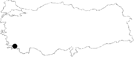
| Location: It is located in the Oren Village of the Milas District; southwest of the Mugla Province. It can be reached from Milas by car within one hour [Tirpan 1989:363]. |
| Geography and Environment: Flowing where the Mountain of Kiran; which is c. 600 m high; allows passage; the Karacay Brook forms a delta leading downward from the plateau. The river originates from the plateau. The water spills into the sea through underground ways. Located on a corner of the alluvial plain deposited by Karacay; it is most likely that Keramos was initially established on the shoreline [Bean 2000:36]. The shore to the west of Keramos is occupied by pebbled beaches interrupted with arable fields. To the east rises the Mountain of Kiran which does not allow passage until Akbük [Bean-Cook 1957:68]. It is known that Keramos; situated between Halikarnassus and Idyma was linked to Stratonikeia by a road passing through Panamara [Tirpan 1989:363]. |
| Destruction Details: |

