| ©The Archaeological Settlements of Turkey - TAY Project | ||||||
|
|
||||||
Kallipolis |
||||||
|
|
||||||
| Ages | Maps | Photos | ||||
| Greek-Roman |
 |
 |
||||
|
|
||||||
|
Type:
|
City | |||||
|
Altitude:
|
m | |||||
|
Diameter:
|
m- Direction: | |||||
|
|
||||||
|
Region:
|
Aegean | |||||
|
Province:
|
Mugla | |||||
|
District:
|
Dalaman | |||||
|
Village:
|
Kizilkaya | |||||
|
|
||||||
|
|
||||||
|
|
||||||
|
TAYEx:
|
- | |||||
|
|
||||||
|
Registration State:
|
For detailed registration information please refer to Turkish pages. | |||||
 |
||||||
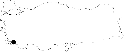
| Location: It is located on a hill locally called Asar; near Duran Ciftlik above the Kizilkaya Village to the east of the Dalaman District of the Mugla Province. To the west it is bordered by the sea; and to the east by the Köycegiz Lake [Bean-Cook 1957:75]. |
| Geography and Environment: |
| Destruction Details: |