|
©The Archaeological Settlements of Turkey - TAY Project
|
|
|
|
|
|
Kallipolis |
|
|
For site maps and drawings please click on the picture... 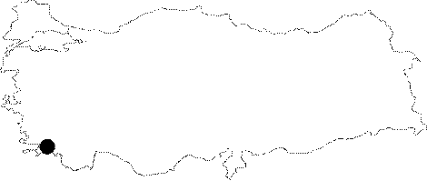 |
For photographs please click on the photo...  |
|
Type:
|
City |
|
Altitude:
|
m |
|
Region:
|
Aegean |
|
Province:
|
Mugla |
|
District:
|
Dalaman |
|
Village:
|
Kizilkaya |
|
Investigation Method:
|
Survey |
|
Period:
|
Classical Hellenistic Roman |
|
|
|
 |
|
| Location: It is located on a hill locally called Asar; near Duran Ciftlik above the Kizilkaya Village to the east of the Dalaman District of the Mugla Province. To the west it is bordered by the sea; and to the east by the Köycegiz Lake [Bean-Cook 1957:75]. |
| Geography and Environment: |
| History: Also mentioned by Stephanus Byzantinus; the city was held by Orontobates together with Myndos; Caunos and Thera in 334 BC based on the information provided by Arrian [Arrian 2; 5; 7]. About 200 BC; it was visited by the Delphic theori; and the name appears in the Rhodian inscriptions dating from the 2nd century BC to the Domitianus Period. Although it was a deme of the Rhodian Peraea and was subject to Rhodes; Callipolis was not incorporated into the Rhodian state [Bean 1976:287]. |
| Research and Excavation: It was visited by Hula and Szanto during the 19th century; and a survey was carried out in 1921 by Guidi; in 1934 by Robert; in 1940s by Fraser and Bean; in 1954 by Bean and Cook. |
| Stratigraphy: |
| Small Finds: |
| Remains: On the hill; there is a tower measuring 7x13 m with a poor masonry. Although no remains of a wall are visible; traces on the ground indicates enclosure of the hill by a wall. What was found in the neighbourhood are six to eight simple graves to the east; a spring on the slope; remains of a building; probably 8x10 m with a 70 cm thick wall over the rocks including the foundation traces of a structure measuring 3x1.5 m with an unknown function. Among the potsherds uncovered on the hill are sherds with ribbled decorations from the Roman Period. There was a small bronze Rhodian coin and a few imperial coins among the coins unearthed in the modern house to the east of the hill [Bean-Cook 1957:75]. An altar dedicated to Domitia by the citizens of Callipolis was found in Duran Ciftlik; which lies 16 km east of Gelibolu; and 2 km southwest of Kizilyaka. It is believed that the remains in this area may have belonged to a sanctuary. In an abandoned house; 2 km east of Duran Ciftlik; some re-used material; fragment of a Doric capital and fragments of columns were found. It is suggested that the ancient city of Callipolis was located near Duran Ciftlik; and the area of the farm might have been a sanctuary of the ancient city; and the name Callipolis was transferred to Gelibolu somehow during the medieval times [Bean 1976:287; Bean-Cook 1957:72-73; 81-85]. It is believed that Callipolis was not originally a Greek city. It was neither included in the Athenian Tribute List; nor mentioned by Hecataeus and Stephanus Byzantinus. The city first appeared as a garrison of Hecatomnus. Depending on the absence of any remains from the Roman Period in Elmali where Kyllandos was located; it was suggested that the settlement had been abandoned in early times; and then resettled in Kizilyaka; a little further to the south under the name Callipolis. Also; it is possible to make a connection between Kyllandos and Callipolis similar to Syangela-Theangela. As known; Syangela also had been abandoned and resettled at another place under the name Theangela. Further investigation is required to obtain more precise information related with Callipolis and Kyllandos [Bean-Cook 1957:84-85]. |
| Interpretation and Dating: |