| ©The Archaeological Settlements of Turkey - TAY Project | ||||||
|
|
||||||
Mallos |
||||||
|
|
||||||
| Ages | Maps | Photos | ||||
| Greek-Roman |
 |
 |
||||
|
|
||||||
|
Type:
|
City | |||||
|
Altitude:
|
m | |||||
|
Diameter:
|
m- Direction: | |||||
|
|
||||||
|
Region:
|
Mediterranean | |||||
|
Province:
|
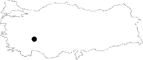
Isparta | |||||
|
District:
|
Egirdir | |||||
|
Village:
|
Sariidris | |||||
|
|
||||||
|
|
||||||
|
|
||||||
|
TAYEx:
|
- | |||||
|
|
||||||
|
Registration State:
|
Registered For detailed registration information please refer to Turkish pages. | |||||
 |
||||||
| Location: It is located at the Goynucek Mevkii; 3 km northeast of the Sariidris Town of the Egirdir District; northeast of the Isparta Province. |
| Geography and Environment: The ancient city of Mallos is situated on a hill in the highlands along the north - south direction for defensive purposes. It is surrounded by the Goynucek Upland to the east; the Ikiztepe and Erenler mountains to the southeast; the Sariidris Town and the Egirdir Lake to the southwest; and the Goynucek Brook to the north. |
| Destruction Details: |