| ©The Archaeological Settlements of Turkey - TAY Project | ||||||
|
|
||||||
Kremna |
||||||
|
|
||||||
| Ages | Maps | Photos | ||||
| Greek-Roman |
 |
 |
||||
|
|
||||||
|
Type:
|
City | |||||
|
Altitude:
|
1200 m | |||||
|
Diameter:
|
m- Direction: | |||||
|
|
||||||
|
Region:
|
Mediterranean | |||||
|
Province:
|
Burdur | |||||
|
District:
|
Bucak | |||||
|
Village:
|
Çamlik | |||||
|
|
||||||
|
|
||||||
|
|
||||||
|
TAYEx:
|
- | |||||
|
|
||||||
|
Registration State:
|
Registered For detailed registration information please refer to Turkish pages. | |||||
 |
||||||
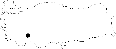
| Location: It is located in the Camlik (Girme) Village; 2 km east of the Bucak District; southeast of the Burdur Province. |
| Geography and Environment: Cremna is situated on a narrow and triangular shaped hill of the Yukari Aksu (Kestros) Valley. The hill inclines down in the east - west direction. |
| Destruction Details: |