|
©The Archaeological Settlements of Turkey - TAY Project
|
|
|
|
|
|
Kremna |
|
|
For site maps and drawings please click on the picture... 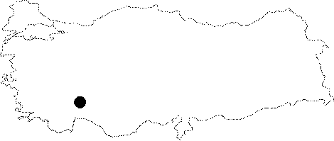 |
For photographs please click on the photo...  |
|
Type:
|
City |
|
Altitude:
|
1200 m |
|
Region:
|
Mediterranean |
|
Province:
|
Burdur |
|
District:
|
Bucak |
|
Village:
|
Çamlik |
|
Investigation Method:
|
Excavation |
|
Period:
|
Roman Hellenistic |
|
|
|
 |
|
| Location: It is located in the Camlik (Girme) Village; 2 km east of the Bucak District; southeast of the Burdur Province. |
| Geography and Environment: Cremna is situated on a narrow and triangular shaped hill of the Yukari Aksu (Kestros) Valley. The hill inclines down in the east - west direction. |
| History: Cremna was referred as a Pisidian city by some ancient writers [Ptolemy 5; 5; 7; Strabon 12; 7; 2]. The foundation of Cremna is dated back to the Hellenistic Period. The first autonomous coin was minted during the 1st century BC. It served as an important fortress for Amyntas between 39-25 BC; then was made a colony of the Roman Empire during the Augustus Period; being renamed as "Colonia Iulia Augusta Felix Cremna". The most prosperous period of the city was during the 2nd century AD. It became one of the most important cities of the Southwestern Anatolia during the Hadrian's Period. The city was greatly destroyed around 225 AD; probably due to an earthquake. The Isaurians who besieged the city were repelled by the Roman army ca. 278 AD. |
| Research and Excavation: The remains of the city were surveyed and identified by G. Hirschfeld between 1872-1874 [Levick 1967a: 40]. J.R.S. Sterrett worked on the inscriptions in the city in 1885. G.K. Lanckoronski outlined an overall topographic plan of the city and defined some of the structures in the same year. The Cremna Forum and Basilica were studied by M.H. Ballance in 1956. J. Inan and her team conducted excavations and researches in the bath and propylon between 1970 - 71. The researchs were continued by S. Mitchell between 1985 - 87. |
| Stratigraphy: |
| Small Finds: |
| Remains: The city is divided into two sections in terms of plan and topography. The eastern section; which is higher; was built on a grill plan. In the western section; on the other hand; the street angles vary in accordance with the slope. Some parts of the city wall of Cremna along with the agora and the colonnaded street are dated to the pre-Roman period. The Hellenistic city center presumably was stretching from the valley to the east of the city [Mitchell-Waelkens 1987: 46]. There are no signs of architectural structures dating to the period between the foundation of the colony to the pre-Hadrian Period. The Hellenistic structures should have been used until the Hadrian's Period. City wall: The city wall is approximately 3 km long. The southern wall of the city that dates to the Hellenistic period stretches from one rock to the other in a meandering form. Some parts of the western walls date to 30 BC when Amyntas invaded Cremna or before. The western city wall is pierced by 12 square-planned towers with a width around 6 m due to the gentle slope of the land. The towers were erected in pseudo-isodomic masonry with irregularly cut stones. The projecting towers may be dated to the Augustus Period; and they are reminiscent of the towers at the ancient cities of Side; Perge and Adada. A bastion built to the north of the western wall contains a section built with dressed stones dating to the Hellenistic Period. The western wall was renovated during the Augustus Period and the Late Imperial Period. No fortification was required in the north of the city due to the steepness of the land. The defensive strength of the city was seriously destroyed when attacked by the Isaurians in approximately 278 AD during the period of Emperor Probus [Zosimos 1; 63-64]. A moat was built during the besiege of Isauria to the north of the western wall to blockade the entire valley. It is 23 m deep; and 140 m long in the east-west direction. The defense system was supported by the enclosing wall erected in in a double row of rough stones. The wall is 800-1000 m long. The wall nearest to the western wall is pierced by six towers with a square plan. Southern Gate: The gate which is located on the southern part of the city was opened into a small square tower measuring 5 x 5.5 m. It is a 2.5 m wide double-arched gate. It was built by uniting two city wall extensions in a corbelling arch plan. The entrance was presumably closed by a wooden door. Having similarities with the Southern Gate at Pednelissus; it was designed for the eastern part of the city. It is accessed via a rocky ramp supported by walls. The road heads west before reaching to the ramp; then makes a straight angle turning to the east; and following the foot of the city wall; it ends up at the Southern Gate. It looks alike the ramp road reaching at the city gate in Pamphylia-Sillyon. The gate was built as a part of the reinforcement program of the fortifications during the reign of Amyntas. Western Gate: It was built adjacent to a tower (#12) to the west of the city. It is 4.6 m wide with a single arch; and it was built during the siege by the Isaurians in c. 278 AD Street: The main street starting at the Southern Gate and ending in the city makes a turn at the first insula and it diagonally heads northeast and passing by the theater; it ends up in the agora. The 8 m wide street connected the eastern part of the city with the city center. The colonnaded street starting at the Western Gate; on the other hand; makes a right turn and follows a straight route until the forum. The route of the colonnaded street divides the city plan diagonally; and connects the city center with the western part. The street intersects with the secondary streets that divide the northern residential areas into insulae. It is 235 m long in the southwest-northeast direction with a width of 9.7 m. The colonnaded street is paved with thick limestone plates covering the drainage system. The colonnaded galleries flanking the street are accessible by a flight of 3 steps. The columns are 3.6 m high standing on bases in Ionic order. The columns are made of granite; and the Corinthian capitals; of limestone. Probably there was a second story built with smaller Corinthian columns only for aesthetic purposes. There seem to have been a row of shops behind the colonnaded galleries. The shops are 7 m wide and 6.5 m long in room plan. The doorways are lightly decorated. Fragments of friezes including spirals decorated with acanthus leaves and rosettes. This type of friezes are common in the architecture of the Southeastern Anatolia. Particularly; it has similarities with the Hadrian's Gate at Attaleia dated circa 129 AD and the decorations of the stage building gate of the Sagalassus Theater dating to 180-195 AD To the east of the street and in the city center found high pedestals for statues. Among them are pedestals belonging to statues of priests; priestesses; and miscellaneous award winners. With all its rich ornaments and statues; the colonnaded street used to screen the simple look of the residential area to the north. It seems that the colonnaded street was built during the second half of the 2nd century AD when the agora became insufficient to meet the increased demand; and that the construction was completed during the reign of Severus. Collapsed during an earthquake in 220 - 230 AD; the street was repaired in the Late Ancient Period. The repairwork greatly damaged the original symmetry and order of the street. Arch: There are three monumental archs on the colonnaded street starting at the Western Gate. The statues of gods and emperor's family were displayed in the aediculae and niches of these archs. Only the piers of the first arch are in situ; and it is 75 m east of the colonnaded street; with two entrances. The second arch at the eastern end of the street has two stories. The upper story is supported by columns with high bases; which is reminiscent of the Agora Gate at Miletus. With its rich ornaments; it rather looks like a gorgeous propylon than an arch. There are two friezes; one in the upper story adorned with acanthus; and the lower one with a theater mask. The frieze of the lower story is similar to the Traianeum at Pergamon from the Hadrian's Period and the lower story frieze of the stage building at the Side Theater from the 2nd century AD The monumental arch is dated to the primary construction phase of the colonnaded street; the 3rd quarter of the 2nd century AD (reign of Antoninus Pius). The third arch at the western end of the street has been seriously damaged. But it is noted that it is not parallel to the street. Agora: It lies to the east of the city. It consists of a paved rectangular area with stoas in Doric order on the east; west; and north edges. The repair works of the Late Period make it harder to sketch the original plan of the agora. The eastern and western colonnaded galleries presumably had a single story in double row of columns. The northern columned gallery has two stories and double naves. A series of 14 shops were identified behind it. The second story with half-columns might have been accessible through a hill to the north of the agora. The colonnaded galleries were possibly topped by a wooden pitch roof. The Agora of Cremna may be dated to 150 - 50 AD depending on the plans and analogies. It was restored and renovated in the 2nd century AD During the renovations; the gap between the outer columns of galleries were filled with walls; and large gates with big arches were built in the north and east directions. Installation of arches into the colonnaded galleries disturbed the intercolumniation. During the renovations; material of the agora was used as resource. The gateways with narrow arches were decorated with the statues of Emperor Hadrian's wife Sabina and Emperor Traianus. Forum: A very few remains survived to the present from the forum located in the eastern part of the city. The paved area in the middle is reached down by six steps. The forum is in rectangular plan surrounded by two-story galleries in Doric order. The northern gallery also forms the southern wall of the basilica providing a passage between the two structures. The columns of the northern and eastern galleries are of the same size. The western gallery might have had a taller and larger façade; which stood on columns taller than others. Although there is a larger gateway in the western section; the main entrance of the forum should have been in the east. The outer surface of the eastern wall bears a triangle pediment. When entered into the forum from the east; the first thing that comes into sight is a two-story gallery. The ornaments of the forum are mainly schematic and ordinary in contrary to the Doric order. L. Fabricius Longus (three times the head magistrate of Cremna; and probably a Tykhe priest) who is the son of Caius; was responsible from the construction of forum; basilica; exedra and marble statues. Following his death; the constructions were completed by his wife; Vibia Tatia; and his daughter; Fabricia Lucilla; and they were dedicated to Emperor Hadrian and to the Divine Emperor Caesar Traianus. With the help of the epigraphical data; the forum is dated to the Hadrian's period. Basilica: It is located to the east of the city; adjacent to the forum. It was built with regular square blocks without plaster. The western wall is pierced by three arched gates. Side archs are 2.8 m wide and 5 m high while the middle one measures around 6 x 10 m. The basilica has three naves. The middle nave has 12 archs supported by square pillars. The southern wall of the basilica continues with colonnades in Doric order (See Forum); which contributed to illumuniation of the southern nave of the basilica. The northern wall is completely obscured by soil. Probably an exedra was added in the eastern wall in the mid-3rd century AD The entablature consists of an architrave with three fasciae; a frieze ornamented with ivy-vine; and a cornice in Ionic order. The structure reflects the character of Ionic/Corinthian order in the 2nd century AD The basilica in Cremna is compared with the basilica in the State Agora at Ephesus. The interfering area of the agora and the basilica in Ephesus forms a political center. The basilica of Smyrna surrounded by columns on three sides (2nd century AD) is also reminiscent of the basilica at Cremna as it extends along the southern border of the agora. The basilica of Cremna was also constructed by L. Fabricius Longus and his family; and dedicated to the Emperor Hadrian and divine Traianus just like the forum. Dated to the Hadrian's Period; it was repairedby a member of the Ulpius family following the earthquake in 220 - 230 AD The basilica was converted into a church in the 4th century AD An apsis was added to the east of the building; and the central nave was made narrower. Following the enclosure of the intercolumniations in the northern gallery; the basilica was separated from the forum. Theater: Two theaters were built in the city. One lies to the south of the basilica-forum complex facing west. Only the external borders of this building could have been identified. The stage building has been collapsed down the slope. The foundation of the second theater was identified on the eastern border of the city. The theater faces the valley to the south; overlooking the city. The outline of the stage building and the rows of seats carved into the rock; which were never completed; can easily be seen. It probably had a 25 rows of seats. The city theater was initially meant to be built at this site; but then left incomplete after finding a spot with a better view. The theater may be dated to the first years of the colony; to the Augustus period. Aqueduct: The only water resource around Cremna is located approximately 2 km southwest to the city. The level difference made it possible to provide water to the city only through an aqueduct. No trace of the aqueduct is available except for some blocks around the water source. It was found out that the water was carried from the water source into the city through large terracotta pipelines installed onto the 1 m wide walls erected by big; rough stone blocks. The best preserved section is the part between the source and the modern city. The aqueduct follows the west over a couple of small valleys. The extant parts from the first section are only the foundations in square forms. The remains are still visible in the second section with two arches over the second and the larger valley. There was a 30 m long wall between the two valleys. It was possible to transfer the water only through a siphon system on the arches by means of pressure due to the level difference between the source and the valleys. A depot was built partly carving into the rock; a little further down between the two valleys. The pressurized water collected in the tank was transmitted into the second section of the aqueduct. Following the second bed; the aqueduct stretches all the way to the top of the low rocky hill facing the western borders of the Hacibag village. Traceable along 250 m; the wall continued until the end of the rock. At this spot; another siphon system was built due to the level difference of 20 m between the rock and the valley. The foundations of thirteen bridge piers are in situ in the valley. To the north of the valley; the aqueduct turns toward the east to the city. Remains of two other aqueducts were found near Cremna. One of them turns to east to the north of the pressure system; and stretches along the east side of the Roman road leading to the city. Among the aqueduct remains are the wall foundation and the fragments of terracotta pipelines. This aqueduct should have only provided water to the southwestern part of the city. The stone wall of the second aqueduct can be seen in the northern part of the pressure system before turning eastwards in the north-east direction. The small structure above the modern water reservoir to the north of the city; measuring 12.5x14.4 m in square plan; and the traces of other small structures probably belonged to the water towers. The towers should have had some machinery that were operated by animal power. The system can be dated to the end of the 1st century AD and beginning of the 2nd century AD Bath: It is located to the south of the Hadrian Forum. The bath; also known as "The Q Structure" is the best preserved structure of the city. Two square rooms of the bath were unearthed during excavations; and traces of a third room were found in the west. The 2.3 wide gate; allowing the main entrance to the bath leads into the east hall after a flight of 3 steps. The hall is relatively large measuring 19.5x29.05 m. The walls of the hall were constructed using local limestone blocks. Each long side of the room has five niches. The mid-section of the east wall is semi-circled in 6 m wide; and covered with mosaic. No data is available about the mosaic decoration because of deposits. The other sections in the east are small; square-shaped; covered with a vault; and paved with stones. The low walls built from mortar with lime debris and broken tiles were covered with pink plaster and thin marble just like the other parts of the building. The central division located in the western wall of the hall has a square plan. A door at the middle of the western wall opens into the other room of the bath. The room in the western part of the hall is 17.4x9.2 m. The walls are covered with marble over plaster. There are three apsidal niches to the west of the room; and one to the north. The western niches are separated by two arched gates; which allow entrance into a third room. During the second construction phase of the building; the arched gates and niches were closed just leaving out the windows; and an asymmetrical entrance was created at the middle niche. The northern wall was built with irregular rubble stones. To the east of the wall lies a window; which was annuled later on; and to the west there is a door; which presumably opened into a small room in the north. The door was; later on; converted into a niche; and the remaining parts were closed by bricks. During the second construction phase of the structure; a bunch of terra cotta pipes was installed into the wall related with the heating system. This section might have been the caldarium or the hot room. Later on the warming system was removed; and the spaces that were left behind were covered with pink plaster. Probably another room was added to the east of the structure. A water canal which surrounds the north of the building; along with the pipework in the main room and the vapor pipes in the small room suggest that it is a bath. Presumably constructed during the Vespasianus period in 69 - 79 AD; it was destroyed during an earthquake in 225 AD The restoration was undertaken by a member of the Ulpius family; but the northern part of the building was rougly repaired. During the same period; the floor of the main hall was elevated about 1 m; and two doors were added into the northern; and one into the northeastern wall. The hypocaust system was cancelled during the restoration. During this phase; the building presumably lost its function as a bath; and was used as the exhibition center for the distinguished people. The statues that were taken from the Hadrian Forum were exhibited in the hall that was paved with new marble tiles. The Flavius Avidius Fabianus Capitonianus and Rutilianus Longillianus Callippus families re-erected the statues of Heracles; Athena (2 pcs); Asclepios; and Hygieia; Apollo; Leto; Aphrodite; Nemesis; and a dressed woman. The statues presumably produced in Docimeion are dated to the mid-2nd century AD The names of the forthcoming families (as in gens Ulpia) of the city were inscribed on the pedestals supporting the statues of gods and goddesses. Additionally found are inscriptions honoring the demos and boule of the city. Cistern: There is a large public cistern consisting of 16 interconnected water tanks to the east of the Temple of Severus. The tanks are in four parallel lines. The cistern is covered with a square consisting of big blocks of limestone above the monumental stairway. The two lines of tanks in the west are in good condition with the exception of the inner parts while the other two lines have been demolished. The tanks are like vaulted square rooms; which are approximately 3.8 m high; 9.2 m wide and 3.4 m long. The walls constructed with small cut limestones were covered with three layers of plaster. The vaults and the fill in material support the pavement of the upper public square. Two or three square holes on each barrel roof helped the water go in. The holes were shut by wheel-like stone grills on the pavement of the square. The transportation of the water between the tanks was realized by terracotta pipelines. The cistern which was interconnected with the Square and the Great Propylon; was constructed within the restoration plan of the area. Nymphaeum: The natural springs located near the South Gate of the city during the Ancient Period was ornamented with a structure. It was constructed on a terrace wall approximately 40 m west of the South Gate on the main road leading to the city. It includes an artifactually enlarged big cave. The rear part is vertically cut by a steep reef. The water from the springs are collected in two adjacent shallow tanks. The tanks were constructed with cut limestone blocks; and they were internally covered with mortar to preserve the water. The rear tank which is the main tank measures 1.3x2 m while the other tank; where the water pours into is 3x0.8 m. The water is transported to the street from the structure of springs by a shallow channel carved into the rock. The lowest row of stones of the structural façade has been preserved in situ between the tank and the cave wall. The stone façade is decorated with marble. It possibly served for the citizens living around the Southern Gate. With its location near the city gate; the nymphaeum is reminiscent of the nymphaeum from the Severus Period at Perge between the Hellenistic and Southern Roman Gates. Sanctuary: Excavations yielded six temples at Cremna; but it was not possible to identify to which deity they were dedicated. The temples from the Roman Period are located in the vicinity of public places such as street; forum and basilica; mostly facing these structures. Temple of Hadrian: It is located between the Little Antonines Temple and the Agora to the east of the city center. The façade of the temple faces the street to the southwest. The Corinthian ordered temple might have had a prostyle plan. There are four or six columns on the façade. Most of the upper structural elements of the temple were found. It has a high and heavy order of architrave. Two big fragments of the cornice and the pediment were found. There are rosettes between the brackets ornamented with rows of eggs. The alikes of the cyma decoration consisting of a row of open and closed palmettes can also be found at the Hadrian Gate in Antalya; the Hadrian Gate in Perge; and the Bath of Aizonai. The temple is dated to the Hadrian's Period based on the analogies; but it is uncertain if the temple was dedicated to Hadrian [Büyükkolancı 1996: 71-3]. There is a three-arched propylon in parallel to the forum and basilica to the south of the area where the Temples of Hadrian and Antoninus are located. The northern façade of the structure called the Little Propylon which is 14 m wide was left plain while the other side was dressed. The east foundations of the structure and the four large blocks of the euthynteria are still visible. It probably allowed the access to the area of the forum and basilica and the sanctuary area to the north through stairways. There are traces of four columns in the uppermost step. The central arch of the propylon was 3.6 m wide; and the side arches are 3.2 m wide. The central arch carried a vertical triangular pediment. The pediment facing the basilica and the forum was ornamented. A twisted column that was found should have been a complementary element of the arched gates of the northern façade and the triangular pediment. The Little Propylon might have been constructed around 150 AD by the same workshop or even the same people that made the decorations of the Temple of Antoninus. Small Temple of Hadrian: It is located in the city center to the west of the forum. The façade faces east; the forum. The foundations of the naos walls and the south doorway of the naos gate as well as the adjacent orthostat block were found in situ. A column of the pronaos section and six steps of the frontal stairway were identified. Additionally; the lintel of the temple gate; a fragment of the architrave; and a fragment of the corner cornice of the pediment were found. The temple is approximately 8.2 m long and 7.7 m wide. It is presumed to be in Ionic or Corinthian order with a prostyle plan [Mitchell 1995: 88]. Probably there were four columns on the façade. The ornamented gate to the east of the temple opens into a paved area. Among the fasciae of the in situ doorway are the kymation of Lesbos; an Ionic kymation on the crown topped by straight and inversely worked friezes of palmettes. Mitchell dates the temple to 115 - 125 AD believing that the decorations on the doorway of the gate reflect the characteristics of the Late Traianus - Early Hadrian Period [Mitchell 1995]. On the other hand; Büyükkolanci indicates that the temple is from the Late Antoninus and the Early Severuses Period depending on the same decorations [Büyükkolancı 1996: 73-74]. Temple of Antonines: It is located near the Temple of Hadrian between the agora and the forum to the east of the city center. The façade faces the main street to the southeast. The threshold of the naos gate survived in situ to the present day. The upper structural elements of the building were all recovered. The temple in Corinthian order and prostyle plan probably had a high podium. It is presumed that the façade had six or even eight columns. The grooved columns stood on octagonal pedestals. The rows of beads between the fasciae and the Lesbian cymation; as well as the Ionic cymation on the crown; and the palmette style of frieze have stylistic similarities with the Antonines Period. The frieze of the temple was ornamented with spiral branches and rosettes in between; which are followed by rows of eggs; a corbelled cornice; and a jagged edge. Among the items found around the temple are an acroter; a pedimental corner; and a cornice with lion head gargoyles in the cyma. Presumably there was an Syrian-type of arch in the middle of the pediment. The fact that the temple had a wall frieze with a girland was determined following the discovery of the antae capital. The wall frieze seen on the Temple of Augustus at the Pisidian Antioch and on the Temple of Dionysus in Sagalassos is an important common characteristic of the Pisidian temples. As understood from the inscription on the architrave; the temple was dedicated to Antoninus Pius (138-161 AD). Temple of Severan Dynasty: It is located in the city center to the northeast of the Grand Propylon. It is proposed that the 15 m long wall to the south of the temple was part of the temenos [Mitchell-Waelkens 1987: 43]. The outer side of the wall was left plain while interior side was decorated with a row of undressed half-columns; which presumably carried a pseudo entablature consisting of an architrave with three fasciae; a convex frieze and a cornice. The temple which is presumed to have 6x11 columns in Ionic order has peripteral plan; probably facing east. It probably had a three-step crepis. A capital in Ionic order found on the eastern side of the temple suggests the presence of a temple in in antis or prostyle plan prior to the temple from the Period of Severan Dynasty. Probably the temple was converted into peripteral plan with the peristyle erected during the Period of Severan Dynasty. The origin of the Ionic capital goes back to the Mauseloum in Halicarnassus; and it was frequently used during the 2nd century AD The most alike example can be seen at the Temple of Leto in Letoon. Some of the fragments from the friezes uncovered around the temple are decorated with figures of bull's head; boar and panther. Lanckoronski indicated that the animal figures on the girlands of the friezes might have been related to Artemis; and therefore; the temple may have been a Temple of Artemis (Diana Coloniae) [Lanckoronski 1892: 170]. Probably the temple was originally built as a temple of Artemis during the Hellenistic Period; and dedicated to Diana Coloniae during the Augustus Period. It was restored as part of a construction program including the streets and the propylon during the Period of Severan Dynasty. It seems that the temple preserved its original location during the restoration. It is located in the city center. It is a two-story building with a three arched entrance. The mid-pediment of the second story is triangular while the side pediments are half-circled. The acanthus motif on the frieze resembles the palmette decoration on the cyma of the Small Temple with Syrian Pediment. The cassettes installed on the lower surfaces of the arches are decorated with small busts surrounded by acanthus leaves. The shadow&light tricks specific to the Period of Severan Dynasty at the end of the 2nd century AD are very impressive. The triangular pediment at the second story includes a Kybele figure; while the half-circle pediments that are in better condition have two Nike figures holding branches of a palm tree with an Athena figure in the middle. Temple of Marcus Aurelius and Commodus: Four fragments of decorated architectural elements were found on the northern side of the Agora. It seems that the remains consisting of a lentil of the gate of the naos and fragments of architrave with three fasciae and inscriptions in Latin are from the Temple of Marcus Aurelius and Commodus. The friezes of the Lesbian and Ionic cymation on the lentil of the gate are apparently in similar style with the decorations of the Small Temple with Syrian Pediment. Analogies suggest that the temple was constructed between 169 AD and 177 AD [Mitchell 1995: 108]. Small Temple with Syrian Pediment: It was built on a high slope to the north; outside the city center. Although the dimension of the rectangular structure is unknown; it should have been smaller than the Small Temple of Hadrian. The façade of the temple presumably faces south; and the façade of the structure contains double square pilasters bearing a Syrian pediment in the middle. The bases of the pilasters have an Attic-Ionic profile with low-capitals. The egg-arrow and bead ornaments of the capitals are crowned with a strip of palmettes. The architrave and the frieze were dressed on the same block. The decorations are reminiscent of the ones at the Small Temple of Antonises and the Small Propylon. It is dated to the same period with the Temple of Marcus Aurelius and Commodus. It is uncertain if the structure; of which the foundations partly survived to today; was a temple or a grave belonging to a rich family. The second alternative seems more rational considering the architecture of façade and the location. Domestic Area: A bigger part of the city was dedicated to domestic area. The city has two residential areas; one to the east and one to the west. The architectural phases of the houses could not be identified due to destruction. The first houses from the 2nd century AD were built with good quality ashlar blocks. Some of the houses have peristyle courtyards and several rooms. In general; the outer walls of the houses were erected roughly with large limestone blocks while the interior walls were elevated by irregular small stones and debris. The interior doors were usually left plain without any decorations. Traces of plaster were found only in one house. The columns; pillars of doors; thresholds; window casings and lentils were made of monolith limestone blocks. The roofs were covered with large; square tiles. There are some small altars and bases in the houses. Most of them have underground cisterns. The water demand was supplied by collecting the rain waters into these underground cisterns. The cisterns are usually flask-like structures; which were easy and cheap to built; or sometimes square-shaped. The houses are built in Roman style except for their local characteristics of plain architecture and decorations; and they reflect the Roman middle-class city life. Western Domestic Area: It covers a large area from the north of the colonnaded street to the western walls. The insulae are not rectangular as the streets were arranged according to the topography. The insula to the north of the colonnaded street was narrowed toward the east in order to follow the axis of the street. This alteration resulted in changes especially in the houses on the northeastern corner. The back streets get narrower from north to south in order to intersect with the colonnaded street in straight angles as much as possible. Shops with simple chambers are lined up alongside the streets in the residential area as independent trade-based units. To the north and south of the area are large houses with central peristyle courtyards. Distinguished with their architecture and dimension; they should have been belonged to the elite class. To the west of the residential area; a major part of the insula no. 4 is occupied by a large and peristyle house with a central courtyard. There is a cistern beneath the pavement of the courtyard. The four grooved columns and a column base of the porticoes were found in situ. A limestone parapet with simple decorations separates the courtyard from the porticoes. However; there is access from the courtyard to the north portico through two narrow gaps. The bedrooms of the house face north. The northern; eastern; southern; and possibly western sides of the house were bordered by streets. To the east; four or five adjacent rooms; probably shops; open into the street. These are separated from the house by a wall. Presumably there was access to the house from the south room. Northern Domestic Area: It is located on a steep rock to the east of the public cisterns. The valley where the city center is located can be seen down the rocks. The houses and the streets in the north-south direction could not be investigated thoroughly as they are obscured by a heavy load of ruins. The houses on the west hill facing the cisterns are located on terraces. It is believed that most of the houses on the steep hill overlooking the city center were magnificent structures. The houses on the hill; which receive sunshine in winter and keep chilly air during summer are visible from all over the city. The most outstanding structure in the area is a peristyle house. A major part of this house facing the northern cliff has been demolished. It measures 45x25.4 m. The porticoes surrounding the courtyard were probably supported by 12 grooved columns. Five columns were found in situ. The variety of columns suggest a two-story building. There might have been a granite-columned large and open area; an exedra or a tablinum. From this area; there is access to the southern portico or probably to the other rooms. There is an apsis in the room on the southwestern corner of the courtyard. The function of this room is unknown. Necropolis/Grave: The main necropolis area of the city is the inclining land outside the western wall. Except for the khamasorion carved into calcerous slopes; the independent burial structures or sarcophagi didn't survive. Small fragments of the marble sarcophagi demonstrate a marble workmanship similar to Docimeion; a favorable workmanship during the 2nd-3rd centuries. Restricted data available about the burial structures show that the architectural graves were not very popular in the city. At the southern rocks; there is a grave structure partly carved into the steep rocks. It is likely that the podium of the grave; which was carved into the rock was stepped. The traces seen on the façade of the 3 m wide structure indicate that it is a prostyle structure. It is limited by the voluted brackets flanking the axis. The rear part of the eastern wall that was built up to a 1.8 m height; is integrated by roughly dressed natural rock. The corners of the south edge were made evident by pilasters. The entablature contains a very rich ornamentation; it consists of a three fasciae architrave; a garland frieze; a jagged-edge cornice and a cyma of lion heads. The interior part of the grave is composed of a simple rectangular room. The original floor has been destroyed due to illicit digging. Traces of a sarcophagus with a triangular enclosure were found in the room. However; it is difficult to date the rock grave of Cremna. It may be dated to the end of the 1st century AD or the beginning of the 2nd century AD The elaborate masonry and the view over the Kestros river indicate that the owner of the grave was a member of the rich class in Cremna. Quarry: It is known that the limestone used in the construction of the city buildings were from a quarry 400 m far from the western walls. |
| Interpretation and Dating: |