| ©The Archaeological Settlements of Turkey - TAY Project | ||||||
|
|
||||||
Karatas Semayük |
||||||
|
|
||||||
| Ages | Maps | Photos | ||||
| EBA 14C |
 |
 |
||||
|
|
||||||
|
Type:
|
Mound and Cemetery | |||||
|
Altitude:
|
1140 m | |||||
|
Diameter:
|
m- Direction: | |||||
|
|
||||||
|
Region:
|
Mediterranean | |||||
|
Province:
|
Antalya | |||||
|
District:
|
Elmali | |||||
|
Village:
|
Bozhüyük | |||||
|
|
||||||
|
Destruction :
|
Agriculture | |||||
|
|
||||||
|
TAYEx:
|
Visited - 18/6/2001 | |||||
|
|
||||||
|
Registration State:
|
Registered For detailed registration information please refer to Turkish pages. | |||||
 |
||||||
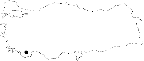
| Location: It lies west of the Bozüyük (Semayük) Village; some 6 km east of the Elmali District; west of the Antalya Province. Elmali-Korkuteli motorway passes 5.1 km west of the mound. It is called Karatas-Semayük in order to prevent any confusion with the mound of Semayük. |
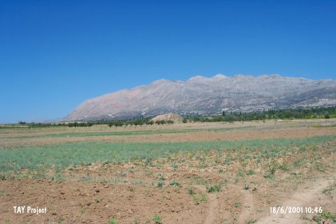
| Geography and Environment: Karatas is located immediate east of the Elmali-Korkuteli motorway on the Elmali Plain; 1200 m high from the sea level; surrounded by the Taurus Mountains. It measures 3-4 m in height and 100 m in diameter. The excavations yielded a settlement and a cemetery. |
| Destruction Details: The mound is being damaged due to agricultural activities [TAYEx 18.6.2001]. |