| ©The Archaeological Settlements of Turkey - TAY Project | ||||||
|
|
||||||
Altin Tepe |
||||||
|
|
||||||
| Ages | Maps | Photos | ||||
| EBA IA |
 |
 |
||||
|
|
||||||
|
Type:
|
Mound | |||||
|
Altitude:
|
100 m | |||||
|
Diameter:
|
m- Direction: | |||||
|
|
||||||
|
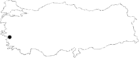
Region:
|
Aegean | |||||
|
Province:
|
Izmir | |||||
|
District:
|
Menderes | |||||
|
Village:
|
Merkez | |||||
|
|
||||||
|
Destruction :
|
Illicit Digging - Agriculture - Contemporary Settlements - Attention | |||||
|
|
||||||
|
TAYEx:
|
Visited - 14/9/2000 | |||||
|
|
||||||
|
Registration State:
|
For detailed registration information please refer to Turkish pages. | |||||
 |
||||||
| Location: It is located northwest of Torbali; 3 km southeast of the Cumaovasi District as the crow flies; south of the Izmir Province. The Izmir-Aydin railway is 80 m east of the mound. Code R 5/11. |
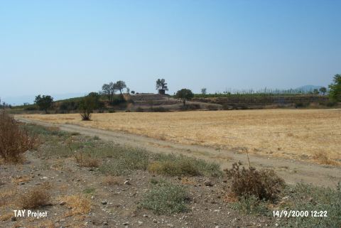
| Geography and Environment: The Tahtali Stream (also known as Bulgurca) formed by the Degirmen and Delibogan streams joining on the north of the mound flows to the east of the mound. The mound stands on a low ridge in a narrow valley. The cultural deposit of the mound is ca. 6 m thick. It has a vertical section extending in the east-west direction [Kaptan 1999:fig.1]. The settlement is ca. 10 ha. wide. The mound is a vineyard at present. |
| Destruction Details: On the northern section of the mound are wide terraces that are said to have been done for cultivation or illicit diggings. They form a profile from the top to the skirts and have severely damaged the settlement. Over the mound are also a pool and a small hut [TAYEx 14.09.2000]. |