| ©The Archaeological Settlements of Turkey - TAY Project | ||||||
|
|
||||||
Karapinar Mevkii |
||||||
|
|
||||||
| Ages | Maps | Photos | ||||
| Palaeolithic/Epipalaeolithic |
 |
 |
||||
|
|
||||||
|
Type:
|
Habitation Site / Workshop | |||||
|
Altitude:
|
1040 m | |||||
|
Diameter:
|
m- Direction: | |||||
|
|
||||||
|
Region:
|
Eastern Anatolia | |||||
|
Province:
|
Elazig | |||||
|
District:
|
Agin | |||||
|
Village:
|
Samançay | |||||
|
|
||||||
|
|
||||||
|
|
||||||
|
TAYEx:
|
Visited - 16/7/2003 | |||||
|
|
||||||
|
Registration State:
|
For detailed registration information please refer to Turkish pages. | |||||
 |
||||||
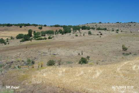
| Location: This site is near the Armutlu quarter of Samançay village; 7 km northwest of the town of Agin; northwest of the city of Elazig. The site is located in Karapinar Mevkii; 1 km south-southeast of the village and close to the dam reservoir. |
| Geography and Environment: The presumed lush vegetation and abundant water sources may have been among the reasons for Palaeolithic habitation in this region. The high number of nearby rock-shelters and flint outcrops were probably additional attractions of this site. |
| Destruction Details: |