| ©The Archaeological Settlements of Turkey - TAY Project | ||||||
|
|
||||||
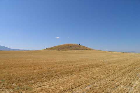
Karaca Höyük |
||||||
|
|
||||||
| Ages | Maps | Photos | ||||
| EBA |
 |
 |
||||
|
|
||||||
|
Type:
|
Mound | |||||
|
Altitude:
|
795 m | |||||
|
Diameter:
|
162 m- Direction: NW-SE | |||||
|
|
||||||
|
Region:
|
Aegean | |||||
|
Province:
|
Denizli | |||||
|
District:
|
Baklan | |||||
|
Village:
|
Içikli | |||||
|
|
||||||
|
Destruction :
|
Illicit Digging | |||||
|
|
||||||
|
TAYEx:
|
Visited - 18/7/2004 | |||||
|
|
||||||
|
Registration State:
|
Registered For detailed registration information please refer to Turkish pages. | |||||
 |
||||||
| Location: |
| Geography and Environment: |
| Destruction Details: Illicit digging pits were seen on the surface of the mound. Especially the east-southeastern section has been severely damaged due to these diggings [TAYEx 18.7.2004]. |