| ©The Archaeological Settlements of Turkey - TAY Project | ||||||
|
|
||||||
Karaburun |
||||||
|
|
||||||
| Ages | Maps | Photos | ||||
| Palaeolithic/Epipalaeolithic |
 |
 |
||||
|
|
||||||
|
Type:
|
Single Findspot | |||||
|
Altitude:
|
m | |||||
|
Diameter:
|
m- Direction: | |||||
|
|
||||||
|
Region:
|
Southeastern Anatolia | |||||
|
Province:
|
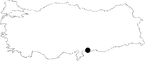
Gaziantep | |||||
|
District:
|
Oguzeli | |||||
|
Village:
|
Karaburun | |||||
|
|
||||||
|
|
||||||
|
|
||||||
|
TAYEx:
|
Not visited - 19/8/2001 | |||||
|
|
||||||
|
Registration State:
|
For detailed registration information please refer to Turkish pages. | |||||
 |
||||||
| Location: This site is southeast of the city of Gaziantep; on the western shore of the Secir Stream; immediately north of the district of Akçakoyunlu. |
| Geography and Environment: North of the city; the Gaziantep Plain flattens as it reaches the Tilbasar and Oguzeli Plains to the south. Çiner; who researched the area; does not provide any information on the location of the site. |
| Destruction Details: |