| ©The Archaeological Settlements of Turkey - TAY Project | ||||||
|
|
||||||
Karabas |
||||||
|
|
||||||
| Ages | Maps | Photos | ||||
| Chalcolithic |
 |
 |
||||
|
|
||||||
|
Type:
|
Flat Settlement | |||||
|
Altitude:
|
100 m | |||||
|
Diameter:
|
m- Direction: | |||||
|
|
||||||
|
Region:
|
Marmara | |||||
|
Province:
|
Edirne | |||||
|
District:
|
Süloglu | |||||
|
Village:
|
Merkez | |||||
|
|
||||||
|
Destruction :
|
Agriculture - Highways, roads, bridges etc. | |||||
|
|
||||||
|
TAYEx:
|
Visited - 14/6/2000 | |||||
|
|
||||||
|
Registration State:
|
For detailed registration information please refer to Turkish pages. | |||||
 |
||||||
| Location: |
| Geography and Environment: |
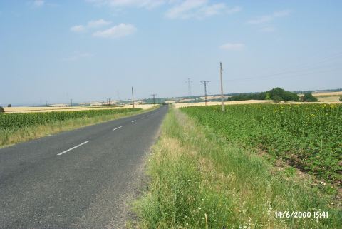
| Destruction Details: The settlement's surface is being used as a wheat field. It is cut by the Edirne-Süloglu motorway in the east-west direction. On the southern side of the road; a high tension electricity post is located directly on the settlement. On the other side of the road there is another old post [TAYEx 14.6.2000]. |